Catalog Archive
Auction 164, Lot 768

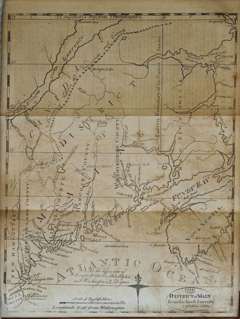
Includes A Very Early Map of Maine

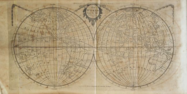
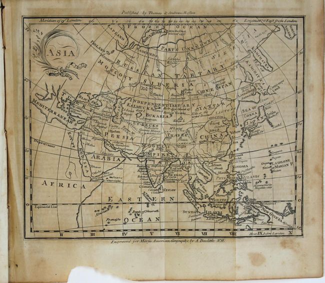
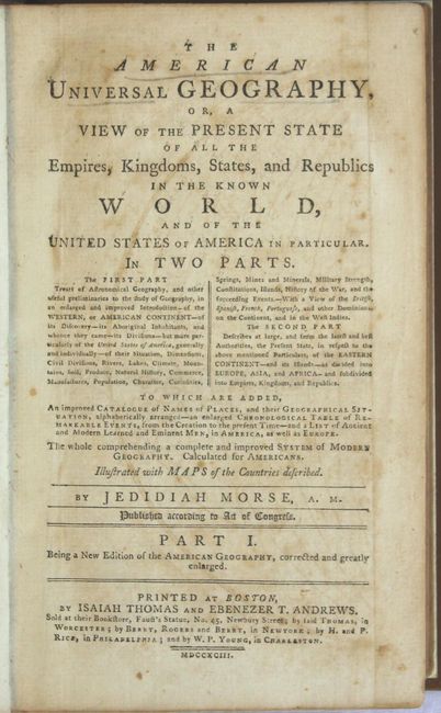
"[2 Volumes] The American Universal Geography, or, a View of the Present State of All the Empires, Kingdoms, States, and Republics in the Known World...", Morse, Jedidiah (Rev.)

Subject: Geography Books

Period: 1793 (published)

Publication:

Color: Black & White

Size:
5.5 x 9 inches
14 x 22.9 cm
Download High Resolution Image
(or just click on image to launch the Zoom viewer)

This married set includes 8 of the 10 called for maps. Part I is dedicated to the Americas and features The District of Main from the Latest Surveys, which is considered the first obtainable map that focuses on Maine. The northwest boundary with Canada has the notation "High Lands Being the Boundaries between the United States and Canada." This gives a northern border further north than that which was eventually decided. Only four counties are noted and Moosehead Lake is misspelled Mousehead Lake. This early edition varies from later Morse issues with finer engraving, a notation to the left of the compass rose, the title contained in an oval cartouche, and no outer neatline. Also included in Part I are maps of the World, Pennsylvania, West Indies, and South America (missing the Purcell Virginia and map of the Middle States). 696 pages, rebound in full faux leather with raised bands and gilt title on spine. Part II describes the Eastern Hemisphere and is complete with nice maps of Europe, Asia and Africa to augment the text. 552 pages, hardbound in full original calf with title label on spine.

References:

Condition: B

The maps have light toning, scattered foxing, and offsetting. Text has light toning and scattered foxing. Part I binding is modern and near fine. Part II binding is moderately worn with abrasions and a chip on the front cover.

Estimate: $400 - $500

Sold for: $200

Closed on 9/13/2017

Archived