Catalog Archive
Auction 164, Lot 722

Fascinating, Large-Scale WWII Pictorial Map

"Nav War Map No. 4 - The North Pacific Area", U.S. Navy Dept.

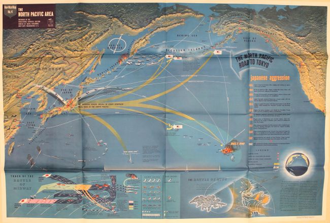
Subject: North Pacific Ocean

Period: 1944 (dated)

Publication:

Color: Printed Color

Size:
57.2 x 38.3 inches
145.3 x 97.3 cm
Download High Resolution Image
(or just click on image to launch the Zoom viewer)

This very large pictorial map was produced by the Educational Services Section of the U.S. Navy. One of the division's primary goals was to inform American service members of the status of the war and to provide context for the battles they would be joining. The map is densely filled with illustrations and text describing the events. Japanese invasion routes are shown in yellow with text stating "The Japanese Struck Boldly at Every Strategic Naval Base in the North Pacific." A United States counterattack is shown along the "North Pacific Road to Tokyo", after the U.S. defeated the Japanese at Attu (Aleutian Islands) in 1943. Insets at bottom include comprehensive accounts of the Battle of Midway and Battle of Attu. Detailed topography is represented with an interesting three-dimensional effect. A vivid depiction of the events in the Pacific theater of war.

References:

Condition: A

Bold color on a clean sheet with a few minor extraneous creases adjacent to the folds.

Estimate: $400 - $600

Sold for: $375

Closed on 9/13/2017

Archived