Catalog Archive
Auction 164, Lot 569

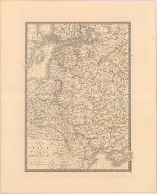
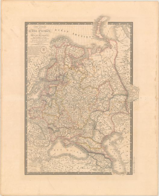
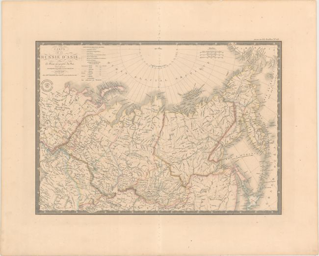
"[Lot of 3] Carte de la Russie Occidentale et du Royme. de Pologne [and] Carte Generale de la Russie d'Europe du Royaume de Pologne... [and] Carte de la Russie d'Asie", Brue, Adrien Hubert

Subject: Russia & Eastern Europe

Period: 1837-38 (dated)

Publication: Atlas Universel

Color: Hand Color

Size:
See Description
Download High Resolution Image
(or just click on image to launch the Zoom viewer)

These three matching maps of the Russian Empire are beautifully and finely engraved with great detail. Each is surrounded with a decorative keyboard-style board, embellished with fancy title lettering and flourishes, and Brue's blind stamped imprint.

A. Carte de la Russie Occidentale et du Royme. de Pologne, dated 1837 (15.0 x 20.3"). This map focuses on the heart of European Russia and includes tremendous detail. It shows all of Poland and extends east to the Black Sea to show all of the Crimea, and north to above St. Petersburg. Condition: Original outline color with light offsetting and minor toning.

B. Carte Generale de la Russie d'Europe du Royaume de Pologne, des Environs du Caucase, et d'une Partie des Pays Adjacents, dated 1838 (15.3 x 21.4"). This map covers the region from Poland and the Baltic nations to the Caspian and south to Turkey (Empire Ottoman). Condition: Original outline color with light offsetting and some damp stains along the sheet's edges.

C. Carte de la Russie d'Asie, dated 1838 (20.3 x 14.3"). This map shows Russia in Asia from the Ural Mountains to Bering Strait. It includes the northern islands of Japan, the Kuril Islands, and Kamchatka. Condition: Original outline color with some soil along the centerfold, light offsetting, and an abrasion and corresponding spot of glue at top.

References:

Condition: B+

See description above.

Estimate: $240 - $300

Unsold

Closed on 9/13/2017

Archived