Catalog Archive
Auction 164, Lot 527

"Nouveau Plan Routier de la Ville et Fauxbourgs de Paris", Esnauts & Rapilly

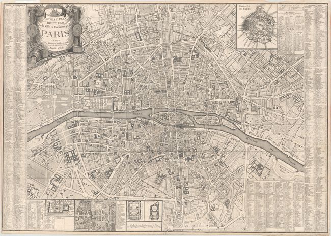
Subject: Paris, France

Period: 1788 (dated)

Publication:

Color: Black & White

Size:
30.4 x 21.5 inches
77.2 x 54.6 cm
Download High Resolution Image
(or just click on image to launch the Zoom viewer)

This large map of Paris shows the city center and is highly detailed with all streets and boulevards located and named. Many important buildings are drawn and named on the map. An index runs along the sides of the map that locates approximately 1,000 additional buildings including theaters, hospitals, churches, colleges, etc. It also identifies major streets using a grid index. Several insets detail Versailles, an overall all plan of the city, two floor plans of theaters, and a plan of the area around the Louvre. The radical upheavals of the French Revolution would begin in the year following the publication of this map.

References:

Condition: B+

Issued folding with some faint soiling, a few small abrasions at the fold intersection at bottom center, and archival repairs to a small hole at the fold intersection and a couple of short, adjacent separations.

Estimate: $300 - $400

Sold for: $300

Closed on 9/13/2017

Archived