Catalog Archive
Auction 164, Lot 458

"Romani Imperii, Occidentis Scilicet et Orientis, Tabula Geographica, ex Schoedis Sansonianis Desumpta, Observationibus Astronomicis Subacta...", Robert de Vaugondy, Didier
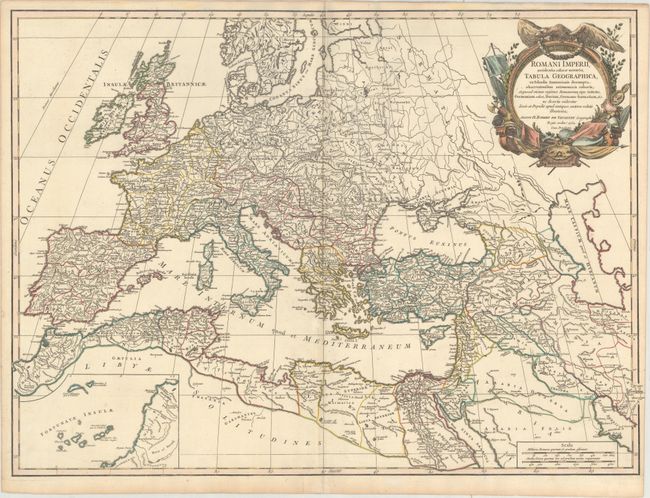
Subject: Europe

Period: 1752 (dated)

Publication: Atlas Universel

Color: Hand Color

Size:
26 x 19 inches
66 x 48.3 cm
Download High Resolution Image
(or just click on image to launch the Zoom viewer)

This map depicts the ancient Roman Empire, extending as far east as the Caspian Sea and the Persian Gulf. Ancient place names are given throughout. An inset shows the Canary Islands. The map is adorned with a decorative title cartouche. This is the first state.

References: Pedley #38.

Condition: B+

Watermarked paper with original outline color and later color in the cartouche. There is a hint of toning along the centerfold, very minor soiling, and an extraneous crease along the centerfold at top.

Estimate: $275 - $350

Unsold

Closed on 9/13/2017

Archived