Catalog Archive
Auction 164, Lot 416
"Kaart van Geheel Guajana of de Wilden-Kust, en die der Spaansche Westindien, op het Noord-end van Zuid-Amerika [on sheet with] Het Island Kurassau [and] Kaart van de Volkplanting aan Demerary en Rio d'Essequebo [and] De Haven en 't Kasteel van Kurassau", Tirion, Isaac
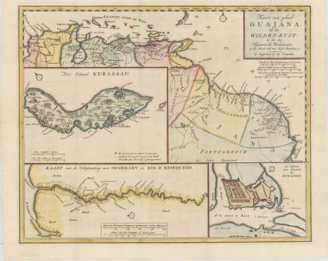
Subject: Guyana, Suriname, French Guiana
Period: 1769 (circa)
Publication: Nieuwe en Beknopte Hand-Atlas
Color: Hand Color
Size:
15.9 x 13 inches
40.4 x 33 cm
Download High Resolution Image
(or just click on image to launch the Zoom viewer)
(or just click on image to launch the Zoom viewer)