Catalog Archive
Auction 164, Lot 388

"Cuba Insula [on sheet with] Hispaniola Insula [and] Insula Iamaica [and] Ins. S. Ioannis [and] I.S. Margareta cum Confiniis", Mercator/Hondius

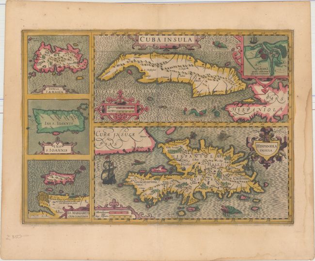
Subject: Greater Antilles

Period: 1613 (circa)

Publication: Gerardi Mercatoris - Atlas sive Cosmographicae…

Color: Hand Color

Size:
19.4 x 13.9 inches
49.3 x 35.3 cm
Download High Resolution Image
(or just click on image to launch the Zoom viewer)

This great, composite map of important islands in the West Indies is presented with two large maps of Cuba and Hispaniola, and smaller maps of Jamaica, Puerto Rico and Isla Margarita along the left side. The map of Cuba includes an inset plan of Havana. The map is richly embellished with a variety of sea monsters, a flying fish, sailing ships and strapwork cartouches. Latin text on verso, published 1613-19.

References: Van der Krogt (Vol. I) #9610:1A.

Condition: A

A dark impression in original color on watermarked paper. There is a light damp stain in the right and bottom blank margins.

Estimate: $950 - $1,100

Sold for: $500

Closed on 9/13/2017

Archived