Catalog Archive
Auction 164, Lot 317

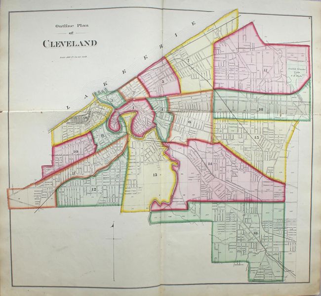
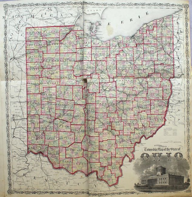
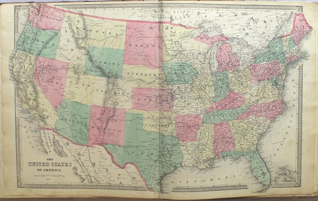
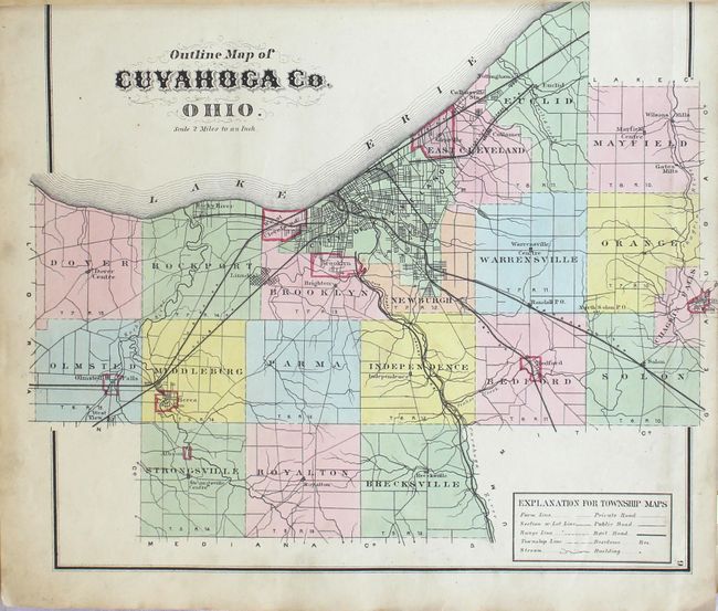
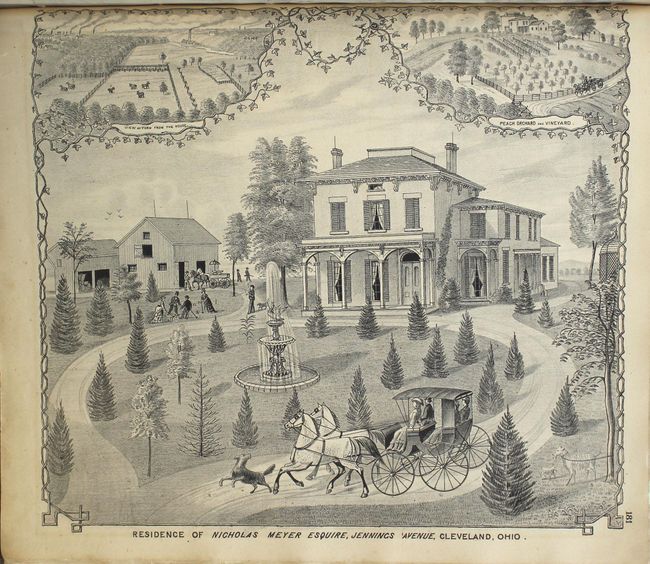
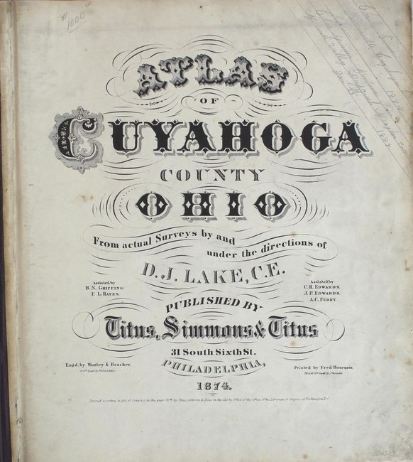
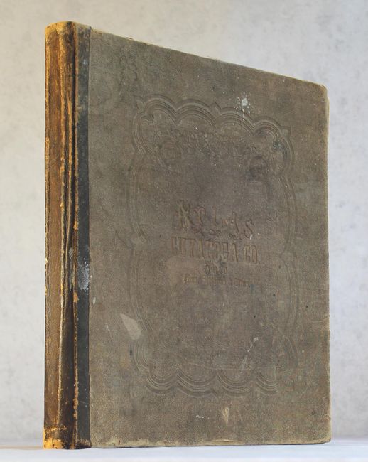
"Atlas of Cuyahoga County Ohio from Actual Surveys by and Under the Directions of D.J. Lake, C.E.",

Subject: Northern Ohio, Atlases

Period: 1874 (published)

Publication:

Color: Hand Color

Size:
14.5 x 16.3 inches
36.8 x 41.4 cm
Download High Resolution Image
(or just click on image to launch the Zoom viewer)

This highly detailed and informative atlas covers all of Cuyahoga County, Ohio and was based upon the surveys of D.J. Lake. It contains a total of 53 maps (13 folding, 11 double-page and 29 single-page maps) depicting the wards within the city of Cleveland as well as townships and villages within the county. Of particular interest is the folding Outline Plan of Cleveland (24.5 x 22"), the folding Railroad & Township Map of the State of Ohio (21.7 x 21.3"), the single page Outline Map of Cuyahoga Co. Ohio. (14.2 x 12.7") and a double-page map of the United States (23.7 x 15.3"). The single-page map South Part of the 6th Ward of Cleveland shows the property of Rockefeller's Standard Oil Company, which was formed only four years prior. The maps show the transportation network, street grid pattern, and a wealth of information about individual properties including both residents and businesses. The maps are augmented by numerous full page illustrations showing some of the well-to-do residences in the county. Published in Philadelphia by Titus, Simmons & Titus. Hardbound in quarter leather over black cloth-covered boards with gilt title on front cover.

References:

Condition: B+

The maps are generally very good with scattered foxing and light soiling,. The three large folding maps have fold separations or small tears along the gutter that have been partially closed on verso with archival tape. Illustrations have overall light toning and the title page has pencil notations in the top right corner. The binding is somewhat loose and there is moderate wear and sunning to the covers.

Estimate: $1,000 - $1,300

Sold for: $650

Closed on 9/13/2017

Archived