Catalog Archive
Auction 164, Lot 223

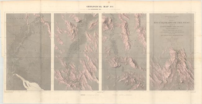
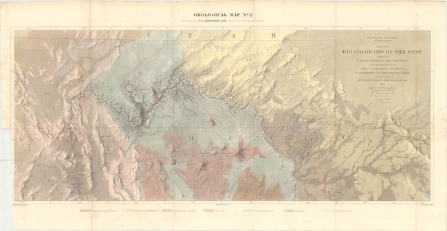
Rare, Early, Geological Maps of the Grand Canyon

"[Lot of 2] Geological Map No. 1 [and] Geological Map No. 2 Rio Colorado of the West explored by 1st Lieut. Joseph C. Ives", Ives, Joseph C. (Lt.)

Subject: Southwestern United States

Period: 1858 (dated)

Publication: Geological Report of the Colorado Exploring Expedition…

Color: Hand Color

Size:
34.9 x 14.7 inches
88.6 x 37.3 cm
Download High Resolution Image
(or just click on image to launch the Zoom viewer)

This rare pair of maps represents the earliest geological maps of the Grand Canyon region prepared as part of one of the most important exploring efforts of the American Southwest. Ives published his explorations in a series of four maps, two topographical and two geological; these being the rarer geological maps. In his book Mapping of the Trans-Mississippi West, Carl Wheat devotes several pages to the topographical versions of these maps saying they are two of the best created by the remarkable F.W. von Egloffstein. They were engraved using his system that imparts the appearance of depth to the topography and nearly mimics a satellite image. A remarkable accomplishment for the time. The maps were prepared by J.S. Newberry M.D., Geologist to the Expedition, with topography by von Egloffstein and lettering by F. Courtenay. Each approximately measures the size given as listed.

References: Marcou & Marcou #784.

Condition: B+

Issued folding with the horizontal fold reinforced with linen on verso. There is minor foxing and binding trims at lower left, with the trim of the second map cut inside the neatline.

Estimate: $500 - $650

Sold for: $750

Closed on 9/13/2017

Archived