Catalog Archive
Auction 164, Lot 213

"[Sketch Map of the Cordilleras of the Western United States] Cordilleras", U.S. Government

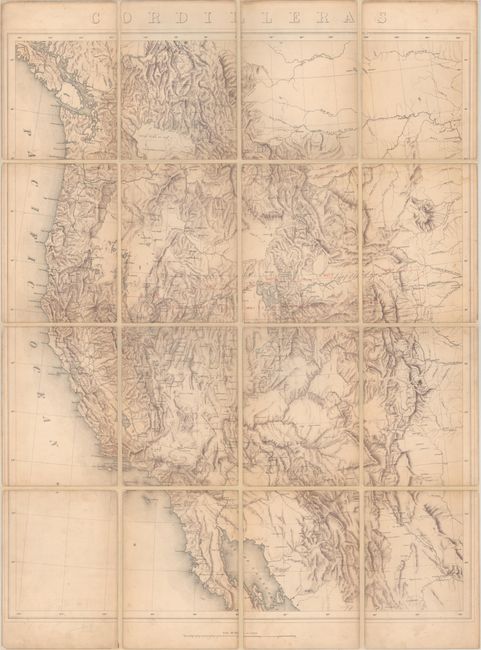
Subject: Western United States

Period: 1876 (published)

Publication: A Geological and Topographical Atlas ... Geological Exploration of the Fortieth Parallel

Color: Printed Color

Size:
22 x 27.6 inches
55.9 x 70.1 cm
Download High Resolution Image
(or just click on image to launch the Zoom viewer)

This is the general index map from Clarence King's Fortieth Parallel survey. Drawn on a scale of 60 miles per inch, it shows the region to the west of the 102nd meridian. Includes very detailed topography depicted through brushwork. Red overprinting identifies 5 areas where more detailed maps are provided in the atlas. Dissected and remounted on heavy tissue with later, brown marbled end boards with paper labels. The folding format and end boards suggest that this example was once used as a field map. An important map seldom offered outside of the atlas.

References: Wheat (TMW) #1270.

Condition: B+

Light toning and a few minor spots of foxing. Issued folding, dissected, and re-backed with heavy tissue.

Estimate: $300 - $375

Sold for: $220

Closed on 9/13/2017

Archived