Catalog Archive
Auction 164, Lot 156

NO RESERVE

"Map of the Various Channels for Conveying the Trade of the North West to the Atlantic Sea-Board Exhibiting the Tributaries & Drainage of the Trade into Each...", Vaughan, David

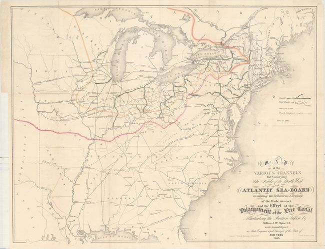
Subject: Eastern United States

Period: 1853 (dated)

Publication: New York State Engineer & Surveyor on the Canals. Annual Report...

Color: Hand Color

Size:
26.1 x 20.7 inches
66.3 x 52.6 cm
Download High Resolution Image
(or just click on image to launch the Zoom viewer)

This uncommon map focuses on the canals and railroads (both in progress and proposed) in the eastern United States. By showing the network of railroads and canals, it provides a fascinating view of interstate trade in mid-19th century United States. Several notable towns and cities are named along the routes shown, indicating their importance to the nation's economy. It extends as far west as the eastern edge of Texas and the Indian and Minnesota territories. Lithography by J.E. Gavit Exchange.

References:

Condition: B+

Issued folding, now flattened and backed with tissue to repair a few tiny splits at fold intersections. Faint offsetting and a binding trim at left.

Estimate: $275 - $350

Sold for: $110

Closed on 9/13/2017

Archived