Catalog Archive
Auction 164, Lot 154

Highly Detailed British Atlas Map Featuring the Independent Republic of Texas

"United States and Texas", Johnston, W. & A.K.

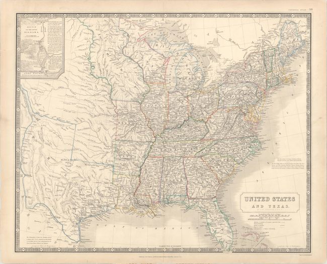
Subject: Eastern United States, Texas

Period: 1842 (circa)

Publication: National Atlas of Historical, Commercial and Political Geography

Color: Hand Color

Size:
24 x 19.6 inches
61 x 49.8 cm
Download High Resolution Image
(or just click on image to launch the Zoom viewer)

This handsome and very detailed map of the eastern United States features the independent Republic of Texas. Typical of British maps of this period, the map is densely engraved with information including an incredible network of roads and trails, built and proposed railways, operational and proposed canals, and lighthouse locations. The territories of Wisconsin and Iowa are both depicted, with Iowa stretching between the Mississippi and Missouri Rivers and extending to the Canadian border. Texas is shown with its borders extending from the Rio Grande to the Arkansas, encompassing Santa Fe and beyond Pike's Peak and James Peak. All of the important settlements in Texas are noted including all the communities along the Rio Grande. A note in the bottom left corner states "The Independence of Texas was formally declared in March 1836. It was recognized by Great Britain in Novr. 1840; and has been acknowledged by the United States, France, Holland and Belgium." In the upper left corner is an inset, Sketch of the River Niagara. There is a note in the Atlantic regarding the Slave-holding States.

References: Day (TX) #1431.

Condition: A

Original outline color on heavy, sturdy paper with a short archivally repaired centerfold separation in the bottom blank margin. There is marginal soiling.

Estimate: $1,100 - $1,400

Sold for: $800

Closed on 9/13/2017

Archived