Catalog Archive
Auction 164, Lot 136

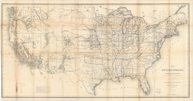
"Map of the United States and Territories. Shewing the Extent of Public Surveys and Other Details...", General Land Office

Subject: United States

Period: 1866 (dated)

Publication:

Color: Hand Color

Size:
55.4 x 28.2 inches
140.7 x 71.6 cm
Download High Resolution Image
(or just click on image to launch the Zoom viewer)

This map is one of the more remarkable maps produced by the General Land Office. It shows the extent of the Public Surveys in 1866 and is filled with features of great interest. Most significant are the gold, silver, copper, and other mineral deposits that are color-coded and keyed to the legend. The sites of army forts and posts provide an excellent view of the undeveloped territories and the western frontier. Details include land grants, townships, subdivisions, railroads, mining districts, etc. Present-day Wyoming is shown as an appendage to Dakota Territory. Made under the direction of Hon. J.S. Wilson, Commissioner, by Theodore Franks.

References: Wheat (TMW) #1137; Phillips (A) #1388-23.

Condition: B

Issued folding with two long separations at left and numerous other small separations primarily at fold intersections. Light toning along the folds.

Estimate: $250 - $325

Sold for: $150

Closed on 9/13/2017

Archived