Catalog Archive
Auction 164, Lot 125

"Louisiane et Pays Voisins, d'Apres les Relations et les Cartes les Plus Recentes", Baudry des Lozieres, Louis Narciss

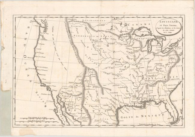
Subject: United States

Period: 1802 (circa)

Publication: Voyage a la Louisiane...

Color: Black & White

Size:
14.2 x 9.4 inches
36.1 x 23.9 cm
Download High Resolution Image
(or just click on image to launch the Zoom viewer)

This map was published in Baudry des Lozieres' Voyage a la Louisiane, et sur le Continent de l'Amerique Septentrionale... According to Streeter, the book title is misleading as "the text contains a rambling history of the French occupation of Louisiana." This was the only map issued in the book and covers nearly the entire present-day United States. To the east of the Mississippi River states are labelled but not engraved, and scores of Indian tribes are identified to its west through the Plains region. Land to the west of the Continental Divide is marked as n'est pas encore connu (not yet known), with the exception of place names along the Pacific coast. Drawn by L. Collin.

References: cf. Streeter 1571; cf. Sabin 3979; cf. Howes B243.

Condition: B+

Issued folding and now flattened with faint scattered foxing. A binding trim at lower left has been replaced with old paper.

Estimate: $475 - $600

Unsold

Closed on 9/13/2017

Archived