Catalog Archive
Auction 163, Lot 440

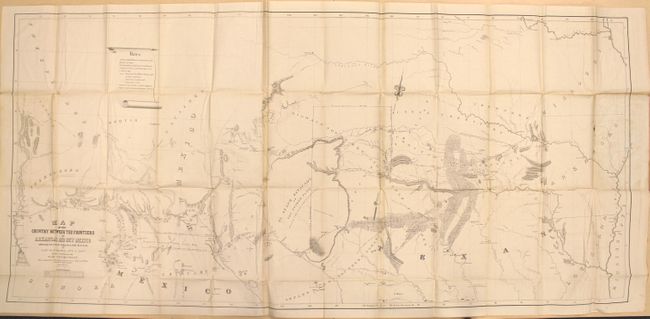
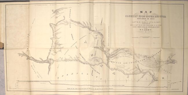
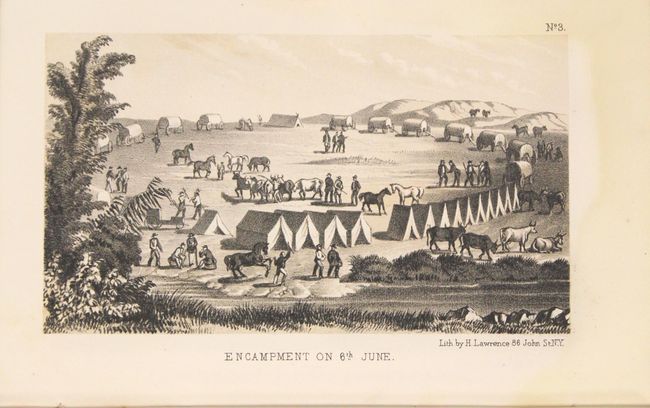
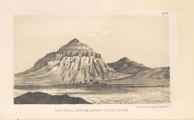
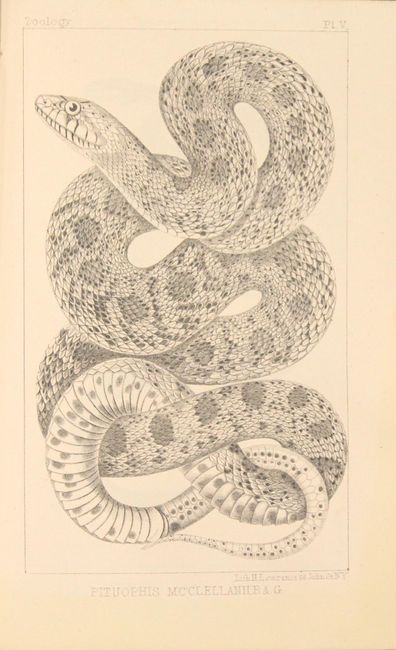
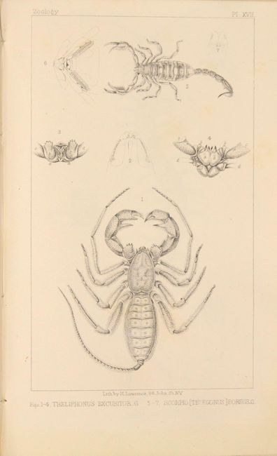
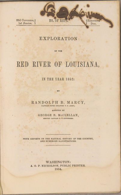
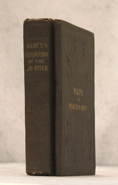
"[2 Volumes] Exploration of the Red River of Louisiana, in the Year 1852 [and] Maps to Marcy's Rept.", Marcy, Capt. R.B.

Subject: Exploration and Surveys

Period: 1854 (published)

Publication: 33rd Congress, 1st Session

Color: Black & White

Size:
5.9 x 9.1 inches
15 x 23.1 cm
Download High Resolution Image
(or just click on image to launch the Zoom viewer)

The U.S. Army expedition commanded by Captain Marcy was the first to discover the source of the Red River. His report abounds in topographical and geographical detail with attention also paid to the customs of the native people in the southern plains. It includes an impressive scope of data, including meteorological and natural history information, with emphasis on geology, paleontology, reptiles, fish, insects and botanicals. Sixty-five beautifully lithographed plates are included, consisting of 12 lithographed views, 10 geological plates (inclusive of one hand-colored fold-out profile section), 6 paleontology plates, 18 zoological plates, and 19 botanical plates. Of particular importance are the two folding map included with the report:

Map of the Country between the Frontiers of Arkansas and New Mexico embracing the section explored in 1849. 50. 51. & 52., (59 x 27.5"). This is a most informative map of the region illustrating the explorations of Capt. Marcy, with inputs from Col. Emory's Boundary Survey, Capt. Sitgreaves' map, as well as those of A.B. Gray and J. de Cordavas. It details the area from the Mississippi River to the Colorado, and from about 30° N. latitude to the Arkansas River. North of the Gila River the region is noted as Unexplored, with a legend reading, "In the vicinity of this place a tract of country is found which is said by several trappers to be exceedingly fertile, and abundantly timbered and well watered." This erroneous note (in the Sonora Desert) shows up a decade later on A.J. Johnson's early maps of the Southwest. Filled with a copious amount of important information and detail on Oklahoma, North Texas, New Mexico and Arizona, the map locates exploration routes, Indian tribes, disputed territories, and more. Wheat considers this map one of the best of the period that "no emigrant could afford to be without it."

Map of the Country upon Upper Red River explored in 1852 (33.8 x 16") is of special interest to Texas and Oklahoma collectors. It covers an area in Texas wholly unexplored previously, including southwest Oklahoma (here Choctaw and Chickasaw Territory). At the time, the only information on the region was from Indians and Indian traders. The map details Marcy's route of exploration through this part of Texas with camp dates, the route of the train from Preston to Warren's T.H. at Cold Spring, Indian villages and settlements, topography and hydrology. Filled with fascinating notations about the land and resources including a large profile of the entire region. Earlier attempts at exploration had been thwarted by the Spanish; Capt. Sparks in 1806, Lt. Pike again in 1806 and Col. Long in 1819-20.

Both volumes are bound in brown cloth with blind stamped covers and gilt title on the front cover of the maps, and gilt title on the spine of the report. Octavo, 286 pages.

References: Wagner-Camp #226:3; Howes #M276; Sabin #44512; Wheat (TMW) #791.

Condition: A

The maps are clean, bright and in unusually good condition with a few tiny fold separations where the map was glued to the boards and a bit of staining from the glue. Plates are near fine, and the text is very good with occasional toning or scattered foxing. The first 130 pages contain a damp stain in the bottom blank margin. A previous owner's signature is on the title page, a page of text, and the verso of both maps (which does not show through). Covers have light shelf wear with a stain on the front cover of the report.

Estimate: $550 - $700

Sold for: $475

Closed on 6/14/2017

Archived