Catalog Archive
Auction 163, Lot 375

"Map of Wiskonsin Territory, Compiled from the Public Surveys", U.S. Government
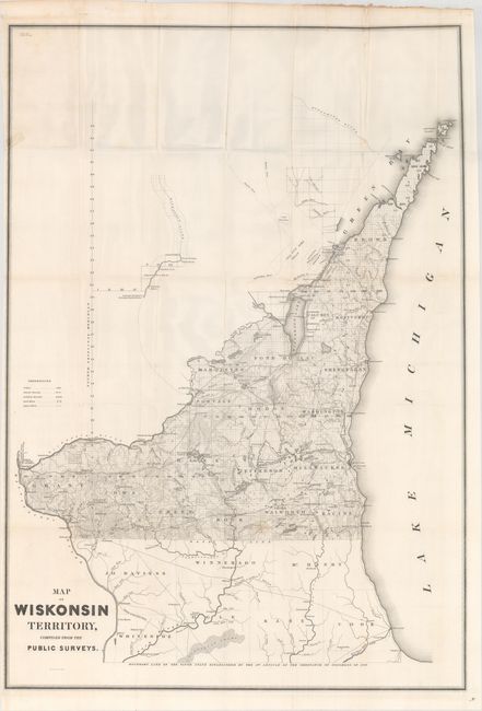
Subject: Wisconsin

Period: 1839 (published)

Publication: Sen. Doc. 140, 26th Congress, 1st Session

Color: Black & White

Size:
24.1 x 34.7 inches
61.2 x 88.1 cm
Download High Resolution Image
(or just click on image to launch the Zoom viewer)

This uncommon and early map of Wisconsin extends from the surveyed part between the Illinois border and the Wisconsin River north to show all of the Door Peninsula. It was compiled from the surveys of Capt. Thomas Jefferson Cram and accompanied his "Report from the Secretary of War…[concerning] the internal improvements in the Territory of Wisconsin…" A skeleton line representing the Wisconsin River continues above the main map and locates a few settlements including Grignon's Trading Post, Whitney's Mill, Bloomer & Co., etc. Illinois is referred to as the "Fifth State Established by the 5th Article of the Ordinance of Congress of 1787." West of Fort Howard is a 500,000 acre tract with the Oneida Indians occupying a portion. Filled with details and place names including many early towns and villages. Large, early and desirable map for the Wisconsin collector. Lithography by W. Stone.

References: Claussen & Friis #329.

Condition: B

Issued folding with a few faint spots, minor extraneous creasing, and a short edge tear at left that has been repaired on verso with cello tape, leaving a small stain visible on verso.

Estimate: $160 - $200

Sold for: $85

Closed on 6/14/2017

Archived