Catalog Archive
Auction 163, Lot 306

"Plan de la Nouvelle Orleans, sur les Manuscrits du Depot des Cartes de la Marine", Bellin, Jacques Nicolas

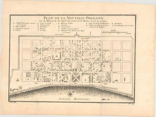
Subject: New Orleans, Louisiana

Period: 1757 (circa)

Publication:

Color: Black & White

Size:
10.9 x 7.7 inches
27.7 x 19.6 cm
Download High Resolution Image
(or just click on image to launch the Zoom viewer)

This attractive copper-engraved plan of the city of New Orleans details the city center including Bourbon Street. Individual buildings are depicted and keyed to a list under the title naming 18 buildings. The plan locates the quay along the Mississippi River, the canal, government buildings, a church, a prison, a hospital, a monastery, and Army and Navy quarters. Bellin's plan was first issued in Charlevoix's History and General Description of New France in 1742 with later versions, such as this, used in several publications. The plan became the standard map of New Orleans throughout the eighteenth century.

References: Lemmon, Magill & Wiese #171.

Condition: A

A nice impression, issued folding on watermarked paper with minor toning and a couple of tiny spots of foxing in the image.

Estimate: $375 - $450

Sold for: $250

Closed on 6/14/2017

Archived