Catalog Archive
Auction 163, Lot 295

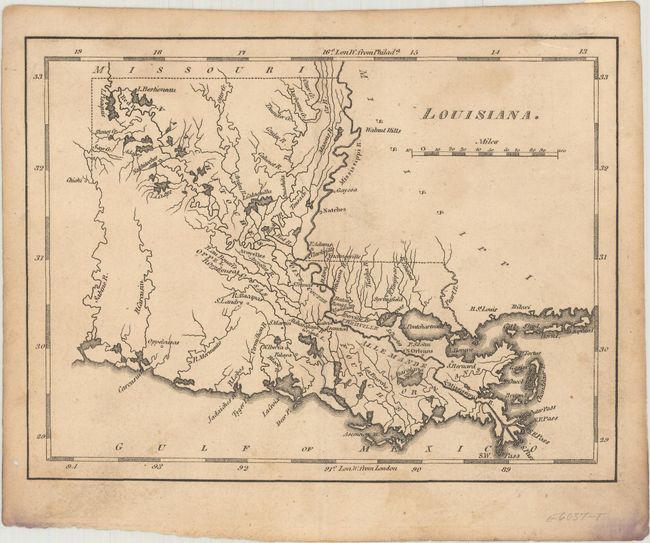
First Published Map of the State of Louisiana

"Louisiana", Carey, Mathew
Subject: Louisiana

Period: 1813 (published)

Publication: American Pocket Atlas

Color: Black & White

Size:
7.6 x 5.8 inches
19.3 x 14.7 cm
Download High Resolution Image
(or just click on image to launch the Zoom viewer)

Mathew Carey was a seminal figure in early American publishing; establishing the first publishing firm to specialize in cartography and issuing the first atlas devoted exclusively to American maps. He set up an elaborate cottage system of craftsmen for compiling, engraving, printing, and coloring maps. This practice was emulated by later American cartographic publishers such as John Melish and Henry S. Tanner. The American Atlas concept was also adopted by other publishers in both the United States and Europe.

This is the first published map to focus exclusively on the new state of Louisiana. It is from a very small run of Carey's important pocket atlas. The map features excellent detail of the watershed and course of the Mississippi River, including the deltas. It locates the early settlements of Adayes (Los Adaes), Natchitoches, Natches (Natchez), St. Landry, Oppelousas (Opelousas), New Iberia, Falaya, St. Bernard, Baton Rouge, and New Orleans. Of special note are the indications of early roads, including the Natchez Trace. This map was published in the 1813 edition of Carey's American Pocket Atlas, which is much less common than his 1814 edition.

References: Phillips (Atlases) #1370-20.

Condition: B+

A nice impression with light stains and soiling and a hint of offsetting. There is a remnant of a piece of hinge tape on verso and a small hole in the left margin.

Estimate: $400 - $500

Sold for: $300

Closed on 6/14/2017

Archived