Catalog Archive
Auction 163, Lot 250

"Map and Profile of the Proposed Road from Opposite Memphis, Tenn. to the St. Francis River, Arkansas T. Exhibiting Also, the Adjacent Country", U.S. War Department

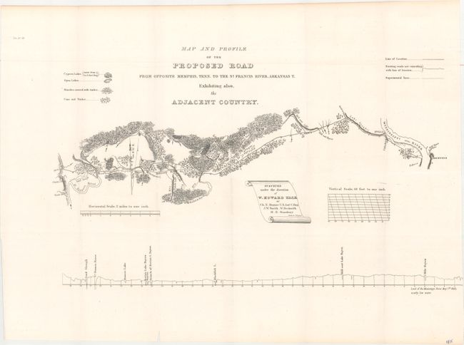
Subject: Eastern Arkansas, Memphis

Period: 1834 (published)

Publication: HR Doc. 83, 23rd Congress, 2nd Session

Color: Black & White

Size:
19.9 x 12.2 inches
50.5 x 31 cm
Download High Resolution Image
(or just click on image to launch the Zoom viewer)

This map extends from the St. Francis River, a tributary of the Mississippi in Arkansas Territory, to Memphis. It traces the route of a proposed road and also depicts existing roads and experimental lines. There is intricate topographical detail of the cypress and open lakes, marshes, cane, and timber of the region. A diagram at the bottom indicates the sea levels of various bodies of water in the area. Surveyed under the direction of W. Howard U.S. Corps of Engineers and drawn by C.N. Hagner.

References: Claussen & Friis #41.

Condition: A

Issued folding with a tiny sliver of the diagram at lower right trimmed away during the binding process. There is a minor ink notation in the bottom right corner, away from the map image.

Estimate: $100 - $140

Unsold

Closed on 6/14/2017

Archived