Catalog Archive
Auction 163, Lot 167

"Georgia, from the Latest Authorities", Reid, John

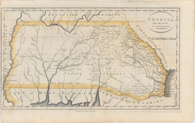
Subject: Southern United States

Period: 1796 (circa)

Publication: The American Atlas...

Color: Hand Color

Size:
15.2 x 8.7 inches
38.6 x 22.1 cm
Download High Resolution Image
(or just click on image to launch the Zoom viewer)

This uncommon map of Georgia is based upon Mathew Carey's map published the previous year. It covers the region from the Atlantic seaboard to the Mississippi River, including present-day Georgia, Alabama and Mississippi. There is good topographical information, particularly for the eastern section near the coast. Early counties in Georgia are named and their boundaries given. The interior is labeled Country of the Creek Nation of Indians with several other tribes located and the notation "These Parts are little known." Several trading paths to the interior are shown. This is the second state of the map, engraved by Benjamin Tanner and published by John Reid in New York.

References: Wheat & Brun #616.

Condition: B+

A dark impression on watermarked paper that has been trimmed to the neatline at left.

Estimate: $700 - $850

Unsold

Closed on 6/14/2017

Archived