Catalog Archive
Auction 163, Lot 164

"New Map of the States of Georgia South and North Carolina Virginia and Maryland Including the Spanish Provinces of West and East Florida from the Latest Surveys", Gordon, William

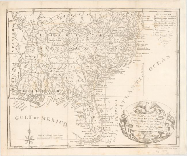
Subject: Southern United States

Period: 1793 (circa)

Publication: The History of the Rise... of the United States... Vol. I

Color: Black & White

Size:
14.6 x 11.9 inches
37.1 x 30.2 cm
Download High Resolution Image
(or just click on image to launch the Zoom viewer)

An attractive and delicately engraved map showing the southern United States with Virginia, North Carolina, and Georgia all extending to the Mississippi River. Florida is under Spanish control and divided between East & West, and beyond the Mississippi River is Spanish Louisiana. The region above the Ohio River is reserved for "New States." This is an updated version of Joseph Purcell's A Map of the States of Virginia, North Carolina, South Carolina and Georgia... with the State of Franklin and the Seven Ranges removed. Adorned by a decorative cartouche with scroll title being held aloft by putti. This map appeared in the second American edition of Gordon's renowned history of the American War. An early American-produced map engraved by C. Tiebout in New York City.

References: Wheat & Brun #495.

Condition: B+

Issued folding and now flattened and backed with tissue to reinforce and repair a 1.5" binding tear at right. There is light scattered foxing and the sheet has been remargined at right to better accommodate framing.

Estimate: $800 - $950

Sold for: $600

Closed on 6/14/2017

Archived