Catalog Archive
Auction 163, Lot 161

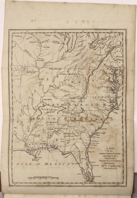
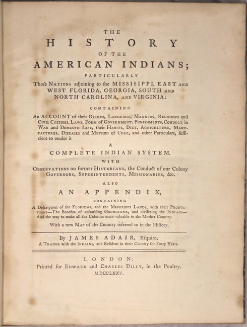
Important History of Native Americans in the Southeast with Map

"[Book with Map] The History of the American Indians; Particularly those Nations Adjoining to the Missisippi, East and West Florida, Georgia, South and North Carolina, and Virginia...",

Subject: Colonial Southern United States

Period: 1775 (published)

Publication:

Color: Black & White

Size:
9.6 x 12.9 inches
24.4 x 32.8 cm
Download High Resolution Image
(or just click on image to launch the Zoom viewer)

James Adair was a frontiersman and fur trader who spent forty years living and interacting with Native American Indians in the Southeast. He was one of the first white settlers to explore the Alleghenies, and spent much of his time with the Cherokee, Catawba and Chickasaw tribes. His work outlines his first-hand information on their religion, customs, beliefs, ceremonies, and language. Although Adair includes a chapter outlining the similarities between Jews and the Native Americans, arguing that the Natives descended from the Jewish people, the majority of his work is filled with astute and valuable observations on Indians. Howes considers Adair's work the "best 18th century English source on the Southern tribes." The frontispieces to Adair's work is a map engraved by John Lodge, A Map of the American Indian Nations, Adjoining to the Missisippi, West & East Florida, Georgia, S. & N. Carolina, Virginia, &c., depicting the southern United States extending north to Lake Michigan and Lake Erie, and west just past the Mississippi River. The map shows the locations of numerous Indian tribes, both common ones such as the Creek and Cherokee, as well as lesser known tribes, such as Ishtahoe and Kow-he-tah. The states are named with the boundaries of Virginia, North Carolina, South Carolina, and Georgia extending west to the Mississippi River. Also of note are several early forts that are identified, including Fort Moore, Fort Conde, Fort Tumbikbe and Fort Toulouse.

References: Cumming (SE) #448; Howes #A38; Sabin #155.

Condition:

The map is lightly toned with moderate offsetting and scattered foxing (B). The text has light toning and scattered foxing (B+). The new covers and spine show very light wear (A).

Estimate: $4,500 - $5,500

Unsold

Closed on 6/14/2017

Archived