Catalog Archive
Auction 163, Lot 132

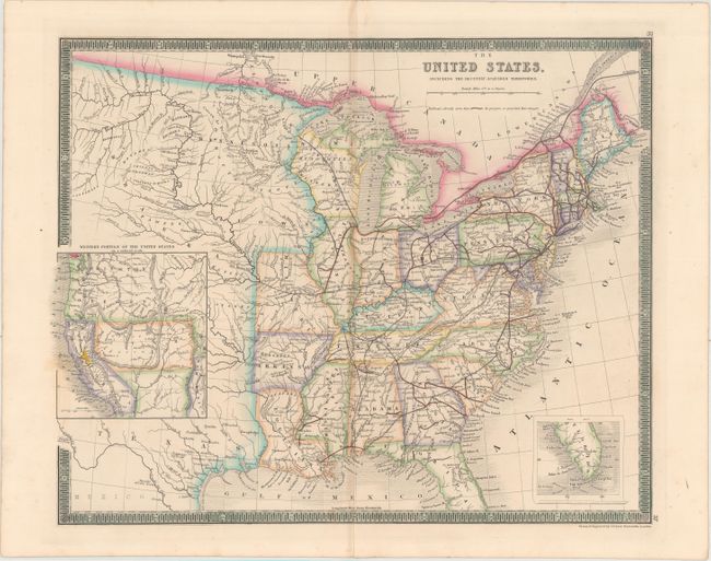
"The United States, Including the Recently-Acquired Territories", Dower, John
Subject: Eastern United States

Period: 1854 (circa)

Publication: A New General Atlas of the World...

Color: Hand Color

Size:
16.6 x 13.3 inches
42.2 x 33.8 cm
Download High Resolution Image
(or just click on image to launch the Zoom viewer)

This map of the United States give great detail of the states in the eastern half of the country, with particular emphasis on the railroads, both completed and proposed. Arkansas and Missouri have outdated shapes circa 1835, despite the fact that this map was published almost 20 years later. The territories to the west are named but not outlined, including a large Nebraska Territory that extends from Kansas to the Canadian border. A large inset at left shows the far western portion of the US, including California with the Gold Region marked by use of color, and large Washington, Oregon, and Utah territories. New Mexico is squeezed to the east of the Rocky Mountains (here called Sierra Madre) and the area of Arizona is left unnamed and nearly devoid of information. Another small inset in the Atlantic shows the southern portion of Florida. This map was published in Henry Teesdale's atlas circa 1854.

References:

Condition: B+

An overall clean and bright example with a few areas of light toning along the centerfold and an archivally repaired centerfold separation that enters 1.5" into image at bottom.

Estimate: $275 - $350

Sold for: $125

Closed on 6/14/2017

Archived