Catalog Archive
Auction 162, Lot 74

"A New General Map of America. Drawn from Several Accurate Particular Maps and Charts, and Regulated by Astronomical Observations", Bowen, Emanuel

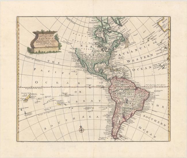
Subject: Western Hemisphere - America

Period: 1757 (circa)

Publication: A Complete System of Geography...

Color: Hand Color

Size:
17 x 13.9 inches
43.2 x 35.3 cm
Download High Resolution Image
(or just click on image to launch the Zoom viewer)

This handsome map of the Americas extends to include the Solomon Islands. In North America, the Pacific Northwest is left open, completely blank and labeled Parts Undiscovered. The coastline stops in the vicinity of Alaska with the notation The Supposed Straits of Annian. The British colonies are shown east of the Appalachian Mountains, with French Louisiana sandwiched between them and the Spanish possession of New Mexico. The only settlements named in the West are Cenis in Texas, Santa Fe and Alamillo in New Mexico, and Casa Grande in Arizona. A very large Lake Superior is shown to contain several islands. In South America, the Amazon River almost connects to the Pacific, and the mythical lake Xarayes L. appears in central Brazil. A decorative cartouche covers the North Pacific and a number of islands are shown in the South Pacific.

References: McCorkle (18th C. Geography Books) #17-21 (Vol II).

Condition: A

A crisp impression on paper with the watermarks of a Strasbourg Lily and the initials "LVG" and "JW." There is light creasing in the blank margins.

Estimate: $300 - $375

Unsold

Closed on 4/26/2017

Archived