Catalog Archive
Auction 162, Lot 736

"Carte de l'Oceanie Comprenant l'Australie, la Polynesie et du Grand Archipel d'Asie", Herisson, Eustache

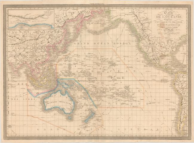
Subject: Pacific Ocean

Period: 1836 (dated)

Publication:

Color: Hand Color

Size:
29.7 x 21.3 inches
75.4 x 54.1 cm
Download High Resolution Image
(or just click on image to launch the Zoom viewer)

This large chart focuses on the various explorations by Cook and La Perouse throughout the Pacific Ocean, which are illustrated along with the year each took place. Detail includes not only all the known islands throughout the Pacific, but also geographic detail in Asia, North America and South America, primarily focusing on mountains and rivers, with only a few cities identified. At top left is an inset showing the coastline of southwestern Australia, centered approximately on the Swan River, which runs through present-day Perth. The region is noted as having been explored by British Captain James Stirling in 1827. Surrounded in a key-board style border. Engraved by Jean Baptiste Tardieu. A very uncommon chart.

References:

Condition: B+

A nice impression with minor toning and several small stains at far right, primarily visible within the title and just below it.

Estimate: $200 - $230

Unsold

Closed on 4/26/2017

Archived