Catalog Archive
Auction 162, Lot 717

"Aphricae Tabula III", Munster, Sebastian

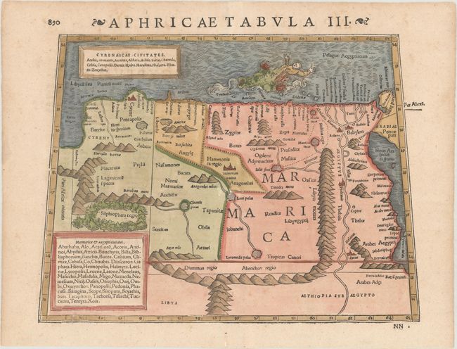
Subject: Northeastern Africa

Period: 1545 (published)

Publication: Geographia Universalis

Color: Hand Color

Size:
13.8 x 10.1 inches
35.1 x 25.7 cm
Download High Resolution Image
(or just click on image to launch the Zoom viewer)

Sebastian Munster (1489 - 1552) was one of the three most renowned cartographers of the sixteenth century, along with Mercator and Ortelius. Munster's Geographia and Cosmographia Universalis were two of the most widely read and influential books of the period. His editions of Ptolemy's Geographia, published between 1540 and 1552, were illustrated with 48 woodcut maps, the standard 27 Ptolemaic maps supplemented by 21 new maps. These new maps included a separate map of each of the known continents and marked the development of regional cartography in Central Europe. The antique geography was a prelude to Munster's major work, the Cosmographia, which was published in nearly 30 editions in six languages between 1544 and 1578 and then was revised and reissued by Sebastian Petri from 1588 to 1628. The Cosmographia was a geographical as well as historical and ethnographic description of the world. It contained the maps from the Geographia plus additional regional maps and city views with nearly 500 illustrations which made it one of the most popular pictorial encyclopedias of the sixteen century.

Classic Ptolemaic map of Northeastern Africa with convoluted mountain ranges, large lakes and rivers. An illustration of a sea monster devouring a man dominates the Mediterranean. A small table at top includes the names of the major cities in Marmarica and a larger legend at bottom notes the major cities in Egypt. Latin text on verso.

References: Mickwitz & Miekkavaara #213-15.

Condition: B+

Minor scattered foxing with a few small worm tracks at center that have been professionally closed, with a minute amount of map image in facsimile.

Estimate: $375 - $450

Sold for: $190

Closed on 4/26/2017

Archived