Catalog Archive
Auction 162, Lot 703

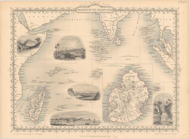
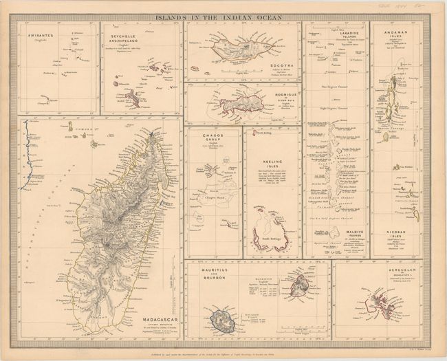
"[Lot of 2] Islands in the Indian Ocean [and] Islands in the Indian Ocean",

Subject: Indian Ocean

Period: 1844-50 (circa)

Publication:

Color: Hand Color

Size:
13.5 x 10.3 inches
34.3 x 26.2 cm
Download High Resolution Image
(or just click on image to launch the Zoom viewer)

A. Islands in the Indian Ocean, by John Tallis, from Illustrated Atlas and Modern History of the World, circa 1850 (13.5 x 10.3"). This beautifully engraved map features vignette views with delicate decorative borders and titling. The main map is centered on the Indian Ocean and extends from Africa and Madagascar to Sumatra including the southern part of India. Names numerous small islands. Uncolored vignettes include "Point de Galle, Ceylon," "Port Louis, Mauritius," "North Beach, Prince of Wales Island," and "Falls of the River Roche, Isle of Bourbon." Additional map of the island of Mauritius is enclosed within a large inset and is very detailed. The vignettes were drawn and engraved by H. Winkles, the map by J. Rapkin.

B. Islands in the Indian Ocean, by SDUK Society for the Diffusion of Useful Knowledge, circa 1844 (15.4 x 12.3"). Contains eleven small maps of the various island groups. This is one of the few 19th century maps to provide detail of some of these islands. Includes: Madagascar; the Amirante Islands; the Seychelles; Socotra; Rodrigues; the Chagos Archiepelago; the Cocos or Keeling Islands; Mauritius and Bourbon; the Laccadive Islands and the Maldives; the Nicobar and Andaman Islands; and the Kerguelen or Desolation Islands. The map is surrounded by a decorative keyboard-style border and was engraved by J. & C. Walker.

References:

Condition: B+

Both sheets are in original outline color with light spots in the image and minor toning.

Estimate: $160 - $190

Unsold

Closed on 4/26/2017

Archived