Catalog Archive
Auction 162, Lot 564

"Italia mit den Dreien Furnemsten Inseln Corsica / Sardinia und Sicilia", Munster, Sebastian
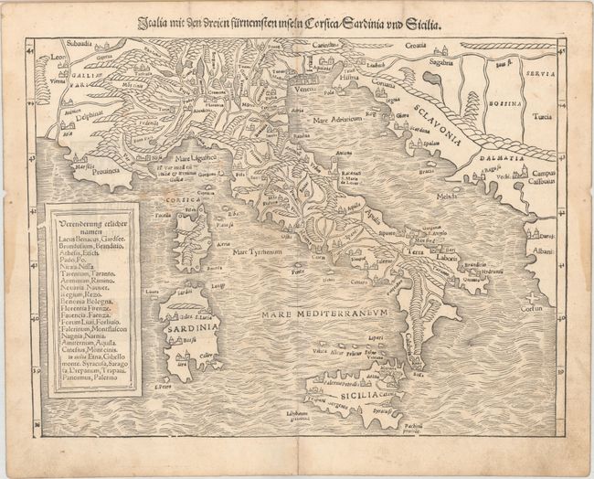
Subject: Italy

Period: 1544 (circa)

Publication: Cosmographia

Color: Black & White

Size:
13.2 x 9.9 inches
33.5 x 25.1 cm
Download High Resolution Image
(or just click on image to launch the Zoom viewer)

Sebastian Munster (1489 - 1552) was one of the three most renowned cartographers of the sixteenth century, along with Mercator and Ortelius. Munster's Geographia and Cosmographia Universalis were two of the most widely read and influential books of the period. His editions of Ptolemy's Geographia, published between 1540 and 1552, were illustrated with 48 woodcut maps, the standard 27 Ptolemaic maps supplemented by 21 new maps. These new maps included a separate map of each of the known continents and marked the development of regional cartography in Central Europe. The antique geography was a prelude to Munster's major work, the Cosmographia, which was published in nearly 30 editions in six languages between 1544 and 1578 and then was revised and reissued by Sebastian Petri from 1588 to 1628. The Cosmographia was a geographical as well as historical and ethnographic description of the world. It contained the maps from the Geographia plus additional regional maps and city views with nearly 500 illustrations which made it one of the most popular pictorial encyclopedias of the sixteen century.

This woodblock map covers all of Italy, Sicily, Corsica, and Sardinia. The map shows the rivers, lakes, mountain ranges, and major cities. The title is in the top margin. German title block and illustration on verso, with Adam Petri's initials engraved in the decorative border.

References: cf. Shirley (BL Atlases) T.MUN-1a #15.

Condition: B

There is light soiling, damp stains mostly confined to the blank margins at right and left, and a couple pairs of small worm holes around the centerfold.

Estimate: $275 - $350

Sold for: $140

Closed on 4/26/2017

Archived