Catalog Archive
Auction 162, Lot 545

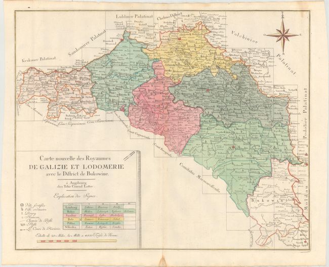
"Carte Nouvelle des Royaumes de Galizie et Lodomerie avec le District de Bukowine", Lotter, Tobias Conrad

Subject: Ukraine & Poland

Period: 1760 (circa)

Publication:

Color: Hand Color

Size:
23.6 x 19.1 inches
59.9 x 48.5 cm
Download High Resolution Image
(or just click on image to launch the Zoom viewer)

This map of parts of present-day Poland and Ukraine describes the Kingdom of Galicia and Lodomeria, which was a crown land of the Habsburg Monarchy that was acquired in the First Partition of Poland. Fortified cities, villages, towns, hamlets, post routes, and post offices are marked on the map, with a French key to the symbols. The title, key, and distance scale are enclosed in a scroll-style cartouche.

References:

Condition: A

A nice impression with original color on watermarked paper, a hint of toning along the centerfold, and a couple of small damp stains mostly confined to the blank margins.

Estimate: $700 - $900

Sold for: $500

Closed on 4/26/2017

Archived