Catalog Archive
Auction 162, Lot 450

"Nouvelle Carte d'Ecosse, ou l'on Fait Observer l'Etat de la Noblesse; les Villes, et les Bourgs qui Deputent au Parlement...", Chatelain, Henry Abraham
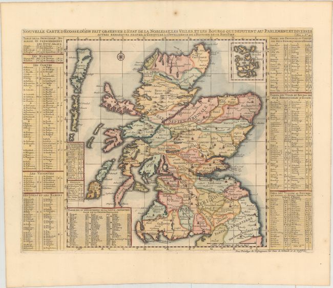
Subject: Scotland

Period: 1708 (published)

Publication: Atlas Historique…

Color: Hand Color

Size:
18.2 x 13.8 inches
46.2 x 35.1 cm
Download High Resolution Image
(or just click on image to launch the Zoom viewer)

Beautifully engraved map with good detail throughout and pictorial representations of topography and towns. The map is roughly 13" x 13" with the title above and tables on either side. These interesting tables list more than 300 towns, villages, baronies, duchies, viscounts, counts and marquis that are keyed to the map. The Orkney Islands are inset at the upper right.

References:

Condition: A

A crisp impression on paper with an "I C H" watermark, minor toning, and a small spot of foxing in the top blank margin.

Estimate: $325 - $400

Unsold

Closed on 4/26/2017

Archived