Catalog Archive
Auction 162, Lot 352

Map of the West Indies Based on Voyage of Hessel Gerritsz

"Insulae Americanae in Oceano Septentrionali, cum Terris Adiacentibus", Blaeu, Willem

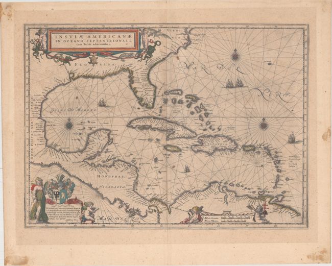
Subject: Gulf of Mexico & Caribbean

Period: 1640 (circa)

Publication: Theatrum Orbis Terrarum

Color: Hand Color

Size:
20.6 x 14.9 inches
52.3 x 37.8 cm
Download High Resolution Image
(or just click on image to launch the Zoom viewer)

This fine map centered on the West Indies reflects the firsthand knowledge of Hessel Gerritsz during his voyage to South America and the West Indies undertaken in 1628. It covers the same region as the Gerritsz map of 1631; from the Chesapeake Bay to the northern coastline of South America, with the addition of the west coast of Central America. The nomenclature in North America is virtually identical with the notable addition of the name Virginia. The nomenclature was probably derived from a Spanish chart as it lacks any French influence. The map is richly adorned with three lovely cartouches, sailing ships, rhumb lines and compass roses. Latin text on verso, published between 1640-43.

References: Burden #242; Van der Krogt (Vol. II) #9600:2B.

Condition: B

Original color with scattered foxing and staining. There is some show through in the blank margins from adhesives used on verso to frame the map.

Estimate: $1,200 - $1,500

Unsold

Closed on 4/26/2017

Archived