Catalog Archive
Auction 162, Lot 32

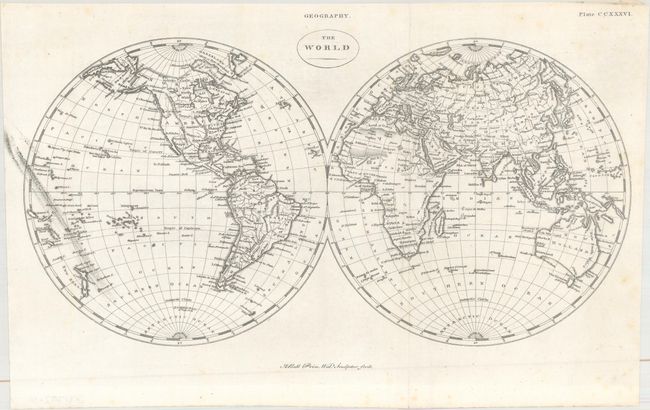
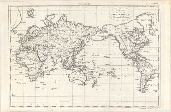
"[Lot of 2] The World [and] A Chart of the World on Mercator's Projection", Bell, Andrew

Subject: World

Period: 1810 (published)

Publication: Encyclopaedia Britannica...

Color: Black & White

Size:
See Description
Download High Resolution Image
(or just click on image to launch the Zoom viewer)

A nice pair of world maps that was issued in the fourth edition of Encyclopaedia Britannica, with title page included.

A. The World (15.4 x 8.0"). A double-hemisphere map of the world that shows the United States confined to the east of the Mississippi River with only New Mexico labeled to its west. Alaska is coming into shape based upon recent discoveries, and a notation in Hawaii indicates "here Capt. Cook was killed." Another note near the South Pole indicates Cook's southern most point was just below 71 degrees.

B. A Chart of the World on Mercator's Projection (14.4 x 9.8"). A simplified map of the world centered on the Pacific Ocean showing continental outlines, countries, and the river systems. North America consists of Canada, the United States, Louisiana and Mexico. The northwestern portion of the continent is blank except for the Stony Mountains. New Guinea is depicted as two islands.

References:

Condition: B+

Issued folding with faint scattered foxing. The double-hemisphere world map has some printer's ink residue along the left side of the sheet.

Estimate: $160 - $190

Unsold

Closed on 4/26/2017

Archived