Catalog Archive
Auction 162, Lot 287

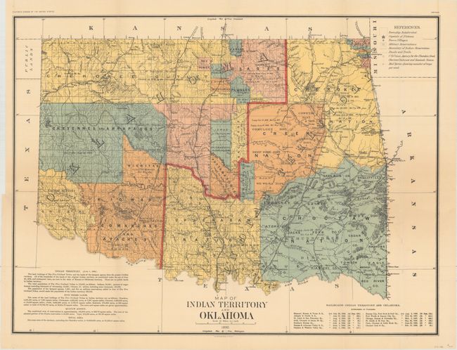
"Map of Indian Territory and Oklahoma", U.S. Government

Subject: Oklahoma

Period: 1890 (dated)

Publication: 11th Census, Report of Indians Taxed and Indians Not Taxed

Color: Printed Color

Size:
29.5 x 22 inches
74.9 x 55.9 cm
Download High Resolution Image
(or just click on image to launch the Zoom viewer)

Large, colorful, and historically significant map showing the newly created Oklahoma Territory, which was created in 1889. This is possibly the only Census Office map showing the two territories together. Both would clamor for admission to statehood. The Dawes Commission would soon extinguish Indian land titles, which led to eventual statehood for the Oklahoma Territory. There is documentary backup for the Indian titles in each of the tribal areas and marginal notes with historical information on the various Indian Lands. Scale of 12 miles to the inch, legend in upper right. Lower right box lists the railroads authorized to operate in Indian Territory. This is the rarer issue from the 11th Census and should not be confused with the more common General Land Office issue.

References:

Condition: A

A clean, bright example with a very short binding tear at left that just passes the neatline and has been closed on verso with archival materials. Issued folding.

Estimate: $500 - $650

Sold for: $350

Closed on 4/26/2017

Archived