Catalog Archive
Auction 162, Lot 222

"Map of the United States Territory of Oregon West of the Rocky Mountains, Exhibiting the Various Trading Depots or Forts...", Abert/Hood

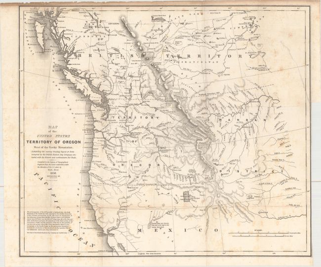
Subject: Northwestern United States

Period: 1838 (dated)

Publication: Monthly Chronicle

Color: Black & White

Size:
20.1 x 17.3 inches
51.1 x 43.9 cm
Download High Resolution Image
(or just click on image to launch the Zoom viewer)

This map was originally issued in an 1838 government report and was reissued in the July 1842 issue of the Monthly Chronicle. The map was intended to awaken public interest in the American occupation of Oregon Territory, which Great Britain also claimed as far south as the Columbia River. Among the many interesting details on the map are the locations of the various trading posts or forts connected with the American and British northwestern fur trade. It covers present day Oregon, Washington, Idaho, Montana and Wyoming. The region east of the Rocky Mountains is named Mandan District. It also shows much of southwestern Canada. The map was copied from John Arrowsmith's 1832 map of British North America. At lower left is the wording of an ultimatum given to the British by Henry Clay, Secretary of State, stating that the 49th parallel will be the boundary. Engraved by M.H. Stansbury.

References: cf. Wheat (TMW) #434; cf. Claussen & Friis #221.

Condition: B

Issued folding with light scattered foxing and toning in the top blank margin. There is a binding trim at right and an associated 4.5" binding tear that has been closed on verso with archival material.

Estimate: $600 - $750

Sold for: $400

Closed on 4/26/2017

Archived