Catalog Archive
Auction 162, Lot 203

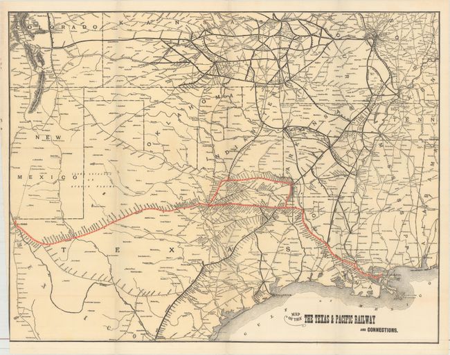
"Map of the the Texas & Pacific Railway and Connections [in] Annual Report of the Texas & Pacific Railway Co. ... 1896", Railroad Companies, (Various)

Subject: South Central United States, Texas

Period: 1897 (published)

Publication:

Color: Printed Color

Size:
23.1 x 17.9 inches
58.7 x 45.5 cm
Download High Resolution Image
(or just click on image to launch the Zoom viewer)

Centered on Texas, the map shows the Texas & Pacific Railroad from New Orleans to El Paso in red overprinting. The map also extends to show connections to St. Louis, Kansas City and points west including Pueblo and Colorado Springs in black overprinting. In addition to the existing rail lines, proposed routes are depicted via dashed lines. Includes the 57 pp. annual report for 1896. Octavo, text enclosed with blue paper wrappers.

References:

Condition: B+

Issued folding with a hint of toning and a trimmed margin at lower left. Covers have some soiling with a few chips to the spine.

Estimate: $180 - $220

Sold for: $190

Closed on 4/26/2017

Archived