Catalog Archive
Auction 162, Lot 194

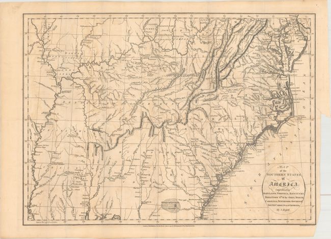
"Map of the Southern States of America, Comprehending Maryland, Virginia, Kentucky, Territory Sth: of the Ohio, North Carolina, Tennessee Governmt., South Carolina, & Georgia", Russell, John C.

Subject: Southern United States

Period: 1795 (dated)

Publication: An Historical, Geographical, Commercial, and Philosophical View of the American United States

Color: Black & White

Size:
19.9 x 14.4 inches
50.5 x 36.6 cm
Download High Resolution Image
(or just click on image to launch the Zoom viewer)

Very interesting map of the early, post-colonial southern states in which Georgia extends to the Mississippi River, sharing land with the Choctaw and Creek tribes. The short-lived reservation that was set aside for the Catawba tribe of Native Americans is shown in a small block on the border between North and South Carolina. This fifteen square mile parcel was set aside for their tribe in 1760. However, nothing was done by the government to remove the ever-increasing white settlers who encroached on the Catawba's land. The tribe sold this land back to the government in 1840. Tennessee is named Tennessee Government. There are several Bounty Land Grants including Colonel Simmes, Donation Lands from the Commonwealth of Virginia, Ohio Company, Wabash Company, New Jersey Company, and Illinois Company. A section of northwestern Virginia is named Indiana. The Iroquois Confederacy originally granted this region to a Philadelphia trading company in 1768. Then in 1776 it was sold to the Indiana Land Company, but was also claimed by the State of Virginia as a part of her original charter. The resulting battle between the private land company and Virginia resulted in the Eleventh Amendment to the U.S. Constitution and is one of the most interesting chapters in the history of the young United States.

References: Phillips (Atlases) #1363-7.

Condition: B

Issued folding with light toning, light offsetting, and a 3" binding tear at right that has been closed on verso with archival tape. The bottom right corner of the sheet has been trimmed, not impacting map image.

Estimate: $475 - $600

Sold for: $350

Closed on 4/26/2017

Archived