Catalog Archive
Auction 162, Lot 175

"A New and Accurate Map of Virginia, and Part of Maryland and Pennsylvania", Lodge, John
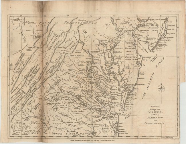
Subject: Colonial Mid-Atlantic United States

Period: 1780 (dated)

Publication: Political Magazine

Color: Black & White

Size:
14.8 x 10.8 inches
37.6 x 27.4 cm
Download High Resolution Image
(or just click on image to launch the Zoom viewer)

This scarce map of the Mid-Atlantic, published during the American Revolution, covers the region from the Chesapeake Bay north to Philadelphia and west to the Appalachian mountains. The map locates George Washington’s Mount Vernon along the Potomac River and magazine text (not included) indicates “In the map we have point out Mount Vernon, the rebel commander’s house. It is finely situated on a very high hill on the banks of the Patowmac.” With a clear British point of view, the map also locates Fort Necessity in present-day Southwestern Pennsylvania, where “Washington [was] taken here” in 1754 during the French and Indian War. This proved to be Washington’s only defeat. Published by J. Bew in London.

References: Jolly #POL-17.

Condition: B

Issued folding with light offsetting and soiling along the left fold. Several fold separations along the left fold have been repaired on verso with old paper. There is a binding trim at lower right.

Estimate: $450 - $550

Sold for: $250

Closed on 4/26/2017

Archived