Catalog Archive
Auction 162, Lot 146

"An Accurate Map of the United States of America, According to the Treaty of Peace of 1783", Russell, John C.

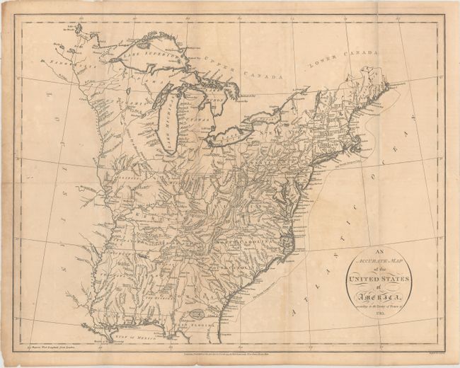
Subject: Eastern United States

Period: 1794 (dated)

Publication: An Historical, Geographical, Commercial, and Philosophical View of the American United States

Color: Black & White

Size:
18.4 x 14.5 inches
46.7 x 36.8 cm
Download High Resolution Image
(or just click on image to launch the Zoom viewer)

This is a very early map of the young United States that details the states, new territories, and the Indian lands east of the Mississippi River. The Western Territories include several Bounty Land Grants including Colonel Simmers, Army Land, Ohio Company, and Donation Lands from the Commonwealth of Virginia, Illinois Company, Wabash Company, and New Jersey Company. The area northeast of the Mississippi River is largely unorganized and denoted as "Divided into 10 States by a Resolve of Congress in 1784." A large section of Kentucky is Land Reserved for the Virginia Troops. The newly formed Tennessee Government is outlined with a large section Reserved for the N. Carolina Troops. Georgia extends to the Mississippi River. Various Indian tribes and forts are indicated throughout. The Twenty Leagues Line is drawn in the Atlantic.

References: McCorkle #794.14; Phillips (A) #1363-4.

Condition: B

Issued folding with light toning and offsetting. There is a 2" edge tear at right that has been closed on verso with archival tape and a few short separations along the horizontal fold.

Estimate: $400 - $475

Sold for: $300

Closed on 4/26/2017

Archived