Catalog Archive
Auction 162, Lot 137

Desilver's United States

"A New Map of the United States of America by J.H. Young", Desilver, Charles

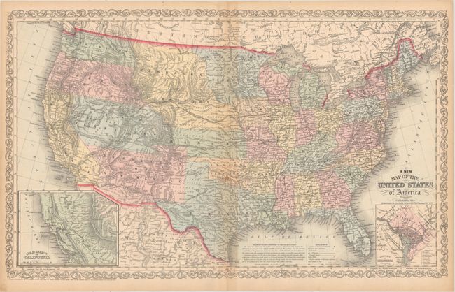
Subject: United States

Period: 1857 (dated)

Publication:

Color: Hand Color

Size:
26.3 x 15.9 inches
66.8 x 40.4 cm
Download High Resolution Image
(or just click on image to launch the Zoom viewer)

This uncommon edition was published by Charles Desilver, 714 Chestnut Street, Philadelphia. It features an inset of the Gold Region of California and contains some of the largest western territorial boundaries. The large Kansas Territory borders Utah and New Mexico as there is no Colorado. Washington and Oregon both extend eastward to the Rocky Mountains at the Continental Divide. Utah and New Mexico are both shown at their largest configuration, with New Mexico occupying the entire Southwest. A large area in the southern portion of today's Nevada is Unexplored Region. Minnesota Territory stretches to the Missouri River, which it shares as a boundary with a huge Nebraska Territory that extends north to the Canadian border and west to the Continental Divide in the Rocky Mountains. The map is filled with details and place names, forts, Indian Tribes, emigrant roads and much more. Several exploration routes are shown, including those of Fremont, Marcy, and Kearney. The proposed routes for the "Great Pacific Railroad" are traced. A second inset contains a plan of the District of Columbia. The map is copyright 1856, but this edition is dated 1857 in the title.

References:

Condition: B+

Light toning along the centerfold and sheet edges along with a few spots of foxing mostly along the centerfold.

Estimate: $250 - $325

Sold for: $170

Closed on 4/26/2017

Archived