Catalog Archive
Auction 162, Lot 132

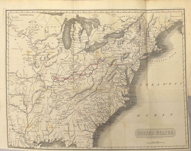
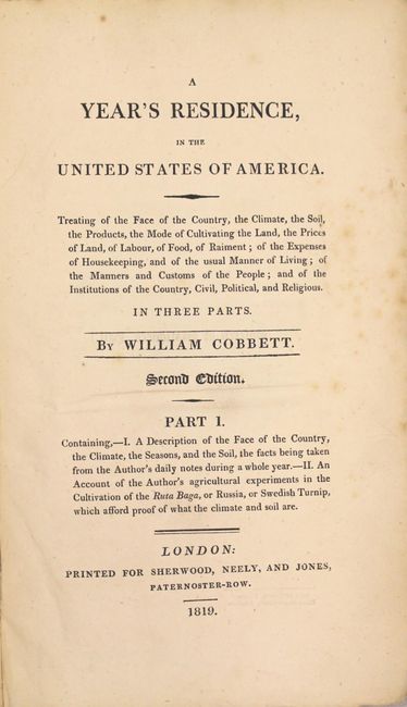
"United States [bound in] A Year's Residence, in the United States of America...", Cobbett, William

Subject: United States

Period: 1819 (published)

Publication:

Color: Black & White

Size:
5.6 x 9.2 inches
14.2 x 23.4 cm
Download High Resolution Image
(or just click on image to launch the Zoom viewer)

This map covers the eastern United States to past the 96th meridian, close to the present-day Missouri/Kansas line. The map is similar, but not identical, to Morris Birkbeck's map of 1818, and shows both the route of Birkbeck and Thomas Hulme to Illinois Territory. Hulme's Journal of a Tour to the West is published in part 3 of this volume. Of cartographic interest, the map presents Illinois approximately 50 miles too far to the west of Lake Michigan, with Indiana completely surrounding the southern part of the lake. Missouri Territory occupies the lands west of the Mississippi River except for the state of Louisiana, with much of the land north of the Missouri River marked "unexplored country." The map is still bound into the 610 page volume consisting of three parts. The volume is disbound and in two sections with paper boards present but separated. Printed on deckle-edge paper. A good candidate for professional rebinding.

References: Howes #C525; Sabin #14021.

Condition: B

The map is very good with light scattered foxing, a few minor closed fold separations, and a tiny binding tear that just passes the neatline at right. Disbound text is generally clean and bright. Separated covers are worn and stained.

Estimate: $250 - $325

Unsold

Closed on 4/26/2017

Archived