Catalog Archive
Auction 162, Lot 110

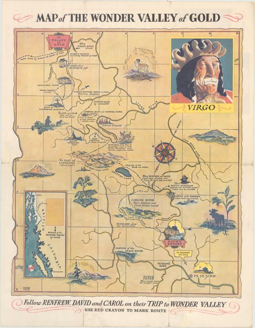
"Map of the Wonder Valley of Gold",
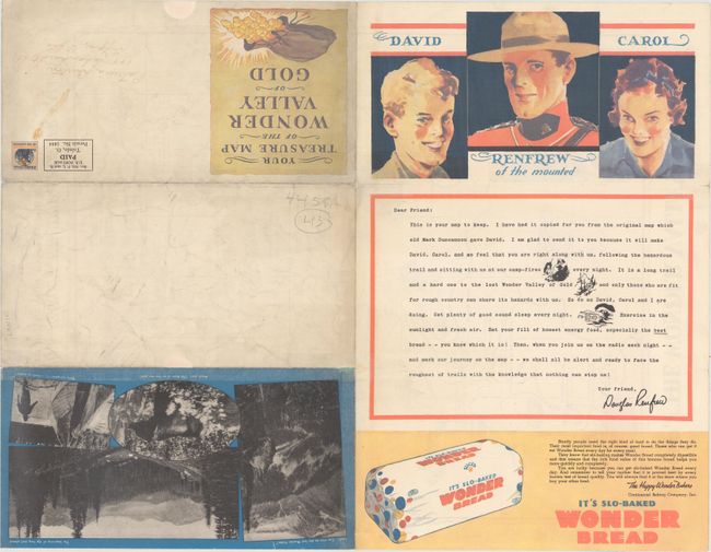
Subject: British Columbia, Canada

Period: 1936 (dated)

Publication:

Color: Printed Color

Size:
15.8 x 18.4 inches
40.1 x 46.7 cm
Download High Resolution Image
(or just click on image to launch the Zoom viewer)

This pictorial map of northeastern British Columbia shows the fictitious route of David and Carol Renfrew to Wonder Valley, British Columbia. It was produced in conjunction with the "Renfrew of the Royal Mounted" radio show (1936-40), and allowed listeners to visually follow the adventure. The map shows the Renfrews adventure beginning in Point Regard, some 400 miles north of the nearest railroad, with their route winding its way up to the "Valley of Gold." The verso contains a letter to the listener, several photo illustrations, and an advertisement for Wonder Bread, who was the program sponsor. Drawn by George Annand. Self-folding.

References:

Condition: B+

Issued folding with a number of fold separations that have been repaired on verso with archival material.

Estimate: $140 - $170

Sold for: $75

Closed on 4/26/2017

Archived