Catalog Archive
Auction 162, Lot 106

NO RESERVE

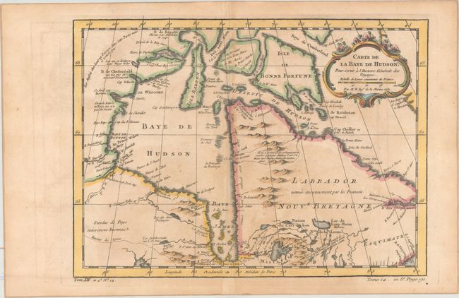
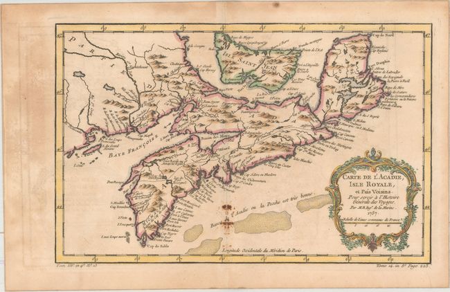
"[Lot of 2] Carte de la Baye de Hudson, pour Servir a l'Histoire Generale des Voyages [and] Carte de l'Acadie, Isle Royale, et Pais Voisins. Pour Servir a l'Histoire Generale des Voyages", Bellin, Jacques Nicolas

Subject: Eastern Canada

Period: 1757 (dated)

Publication: Histoire Generale des Voyages

Color: Hand Color

Size:
See Description
Download High Resolution Image
(or just click on image to launch the Zoom viewer)

A. Carte de la Baye de Hudson, pour Servir a l'Histoire Generale des Voyages, (12.0 x 8.8"). Handsome example of this chart of the Hudson Bay and Labrador, depicting the mountains and coastal features and including numerous forts. There is a note in French in the far northwest corner of the map explaining that the English had searched for a Northwest Passage in that region, but it did not exist. Embellished with a decorative title cartouche. Ref: Kershaw #461; Portinaro & Knirsch, p. 242; Sellers & Van Ee #304. Condition: A nice impression on watermarked paper with toning, light scattered foxing, and offsetting.

B. Carte de l'Acadie, Isle Royale, et Pais Voisins. Pour Servir a l'Histoire Generale des Voyages, (13.0 x 8.4"). This strongly engraved map covers all of Nova Scotia including Cape Breton. Prince Edward Island, here called Isle Saint Jean, is shown in good detail, and Nova Scotia is in part named as Acadie. South of Nova Scotia numerous banks are noted where 'la Pesche est tres bonne' (the fish are very good). The Micmac tribe is named near Shelburne. This map was published shortly after the 1755 expulsion of Acadians from this region. Although the Acadians were able to come back in 1764, many had settled in Louisiana and did not return. Ref: Kershaw #783. Condition: A nice impression on watermarked paper with some stains around the centerfold at bottom, light offsetting, and toning.

References:

Condition: B

See description above.

Estimate: $180 - $210

Sold for: $85

Closed on 4/26/2017

Archived