Catalog Archive
Auction 161, Lot 810

NO RESERVE

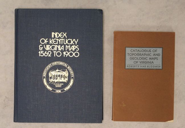
"[Lot of 2] Index of Kentucky & Virginia Maps 1562 to 1900 [and] Catalogue of Topographic and Geologic Maps of Virginia",

Subject: References

Period: 1939-76 (published)

Publication:

Color: Black & White

Size:
See Description
Download High Resolution Image
(or just click on image to launch the Zoom viewer)

A. Index of Kentucky & Virginia Maps 1562 to 1900, by the Kentucky Historical Society, published 1976 (8.7 x 11.3"). This may be the only reference to specifically focus on maps of Kentucky. Compiled by James W. Sames III and edited by Lewis C. Woods, Jr. for the Kentucky Historical Society, it is an index with over 5000 maps of Kentucky and/or Virginia. John Filson's landmark and very rare map of Kentucky is pictured in black and white opposite the title page. Hardbound in blue cloth with gilt title on the spine and gilt title and Kentucky Historical Society emblem on the cover. 287 pp. Condition: Contents and covers tight. There is minor shelf wear. (A)

B. Catalogue of Topographic and Geologic Maps of Virginia, by Joseph K. Roberts and Robert O. Bloomer, published 1939 (6.1 x 9.1"). This useful reference lists 970 topographic and geologic maps of Virginia, ordered chronologically, spanning the years 1782 to 1939 (the year of the book's publication). It also includes a list of geological formations in the state and a table of geologic formations by William Barton Rogers (1804-1882), a noted geologist, physicist, and educator at the University of Virginia whose portrait appears opposite the title page. Soft covers. 246 pp. Condition: Contents good with minor toning to the pages. Covers have some minor wear and a couple small chips in the bottom corners. (B+)

References:

Condition:

See description above.

Estimate: $90 - $120

Sold for: $21

Closed on 2/8/2017

Archived