Catalog Archive
Auction 161, Lot 798

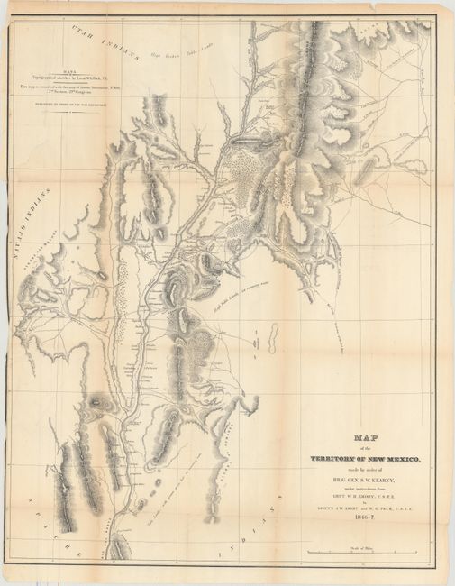
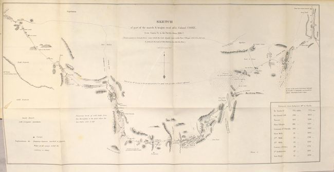
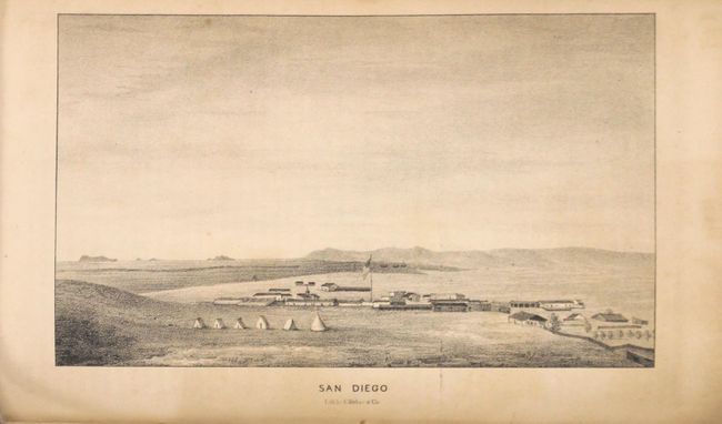
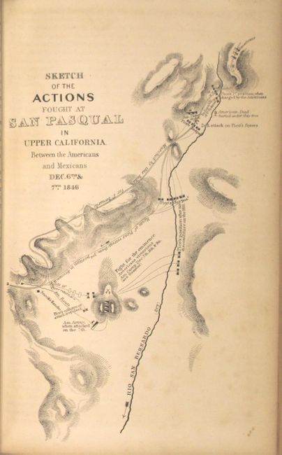
"Notes of a Military Reconnoissance, from Fort Leavenworth, in Missouri, to San Diego, in California, Including Parts of the Arkansas, Del Norte, and Gila Rivers", Emory, William Hemsley

Subject: Exploration & Surveys

Period: 1848 (published)

Publication: Sen. Ex. Doc. No. 7, 30th Congress, 1st Session

Color: Black & White

Size:
5.9 x 9 inches
15 x 22.9 cm
Download High Resolution Image
(or just click on image to launch the Zoom viewer)

This Senate edition is one of the most comprehensive and desirable forms of this report which was issued with the Abert and Cooke maps, but without the very large Emory map. The report documents the 1846-1847 journey of the advanced guard of General Kearny's Army of The West. Emory was Brevet Major of the Corps of Topographical Engineers. The report features full-page lithographs of the natives, rivers, landscapes, towns and pueblos, flora and fauna that were encountered during the march to the Pacific. Emory's reports are enjoyable reads with passages such as "I stopped in the little town of Isoletta, to visit my friend, the alcalde, who has the reputation, Indian though he be, of being the most honest man and best maker of brandy in the territory."

It is illustrated with 64 lithographed plates (40 Emory + 24 Abert), 3 battle plans, and 2 folding maps. The maps are both important contributions to western cartography. The first map,Map of the Territory of New Mexico (25.5 x 19.5") was compiled by Lieutenants Abert and Peck after the conquest of New Mexico. The second, Sketch of Part of the March and Wagon Road of Lt. Colonel Cooke, From Santa Fe to the Pacific Ocean (12 x 23") shows the route of the Mormon Battalion from Santa Fe to the Gila River. Among the important illustrations are views of San Diego (the first published view), several New Mexican pueblos, the Junction of the Gila and Colorado Rivers (Yuma), and Sketch of the Battle of Los Angeles Upper California Fought Between the Americans and the Mexicans Jan. 9th 1847. Wagner-Camp states "his report was a major contribution to the geographical knowledge of North America" and "Emory's descriptions of the various Indian tribes that he encountered were steps toward the newly-forming discipline - Anthropology - concerned with primitive man."

Printed by Wendell and Van Benthuysen. 614 pages. 8vo. Hardbound in quarter leather and tips over brown paper boards.

References: Wheat (TMW) #505 & 532; Wagner & Camp 148:5; Howes #E145.

Condition: B

The map of New Mexico has light toning along the folds and an 8" binding tear in the top left corner of the sheet that has been closed on verso with archival tape. Text and plates are very good with light scattered foxing. Front cover has separated from the binding and the spine is chipped in several places.

Estimate: $500 - $650

Sold for: $300

Closed on 2/8/2017

Archived