Catalog Archive
Auction 161, Lot 72

"Hemisphere Occidental", Brion de la Tour/Desnos

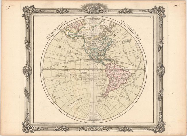
Subject: Western Hemisphere - America

Period: 1768 (circa)

Publication: Atlas General et Elementaire

Color: Hand Color

Size:
12.4 x 11.2 inches
31.5 x 28.4 cm
Download High Resolution Image
(or just click on image to launch the Zoom viewer)

This attractive hemisphere map is surrounded in a decorative picture-frame style border that was printed from a separate copper plate. Cartographically, Brion has devised an ingenious way to show the competing theories of the Pacific Northwest. Philip Buache's concepts, including the mythical Mer de l' Ouest and B. de l' Ouest with its Northwest Passage, are engraved in faint hachure and colored in yellow. While the ideas of Gerhard Friedrich Muller, which includes the fabled River of the West (R. de l' Ouest) connecting through a network of lakes into both Lake Superior and Hudson Bay, are shown by a solid line. There is no sign of Antarctica and the coastline of New Zealand is indistinctly shown. The oceans are filled with the tracks of the major explorations. Brion de la Tour's Atlas General et Elementaire was first published in 1766, with subsequent editions in 1767, 1768, 1778, 1782, and 1786.

References: McGuirk #129; Shirley (BL Atlases) T.BRI-3a.

Condition: A

Full original color on watermarked paper with light toning along the edges of the sheet and minor remnants of hinge tape on verso.

Estimate: $140 - $170

Sold for: $100

Closed on 2/8/2017

Archived