Catalog Archive
Auction 161, Lot 51

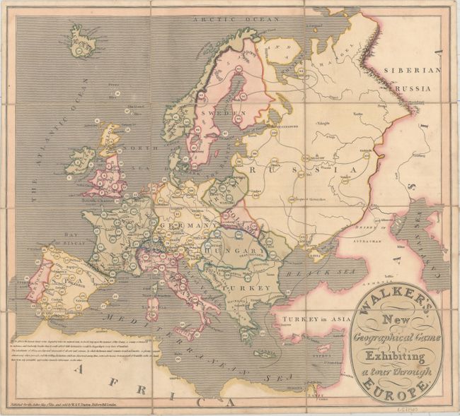
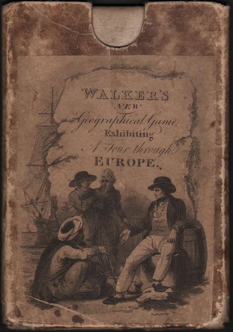
"Walker's New Geographical Game Exhibiting a Tour Through Europe", Darton, William

Subject: Cartographic Miscellany, Game, Europe

Period: 1810 (dated)

Publication:

Color: Hand Color

Size:
19.3 x 17.4 inches
49 x 44.2 cm
Download High Resolution Image
(or just click on image to launch the Zoom viewer)

This simple map of Europe is the game board for a geographical game. A numbered route throughout Europe is shown, beginning in London with "1" and ending in Athens with "133." The game extends as far east as Astrakhan, Russia, just west of the Caspian Sea. Although the game is titled "A Tour Through Europe," and therefore one wouldn't expect a detour outside of the continent, a note in northern Africa gives all the more reason to stay safely in Europe: "In Africa the human mind seems degraded below its natural state, to dwell long upon the manners of this country, a country so immers'd in rudeness, and barbarity, (besides that it could afford little instruction) would be disgusting to every lover of mankind." Quite a harsh statement for a game used to educate children.

The game is played with a marker for each player and an eight-sided teetotum spinner, which were not included with the game. A booklet was issued with the game, outlining the rules and explaining what rewards or consequences would occur when landing on each numbered space, as well as providing information on the history and commerce of the city. The rules booklet is not included in this example. Dissected and mounted on original linen, folding into original paperboard slipcase with engraved paper title label. An early example of the "Cartographic Game" genre that became very popular in later Victorian England.

References:

Condition: B+

Original color with light soiling. Slipcase is well worn but still sturdy and fully intact.

Estimate: $550 - $700

Sold for: $400

Closed on 2/8/2017

Archived