Catalog Archive
Auction 161, Lot 487

Rare State of Jansson's Carte-a-Figures Map of Europe

"Nova Europae Descriptio", Jansson, Jan
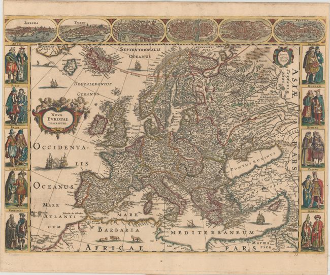
Subject: Europe

Period: 1660 (circa)

Publication:

Color: Hand Color

Size:
21.6 x 16.1 inches
54.9 x 40.9 cm
Download High Resolution Image
(or just click on image to launch the Zoom viewer)

This magnificent carte-a-figures map of Europe extends to include Iceland, the imaginary island of Frisland, and a bit of Greenland. It is flanked at sides with pairs of costumed figures from ten European countries. At top are six vignette views of the cities of Lisbon, Toledo, London, Paris, Rome, and Venice. The map is very finely engraved and further embellished with a title cartouche surmounted by putti, ships sailing the seas, and lions in northern Africa. This map was originally published by Jodocus Hondius the Younger with a lower border depicting additional town views. The bottom border was removed by Jansson to fit in smaller atlases, and was only published in three editions between 1638-58. Jansson then re-engraved the title cartouche along with other embellishments, as seen in this example, however by this time the map had been replaced with a more modern map of Europe omitting the carte-a-figures borders. This third state was not included in any of Jansson's atlases and was likely separately published, thus making surviving examples very rare.

References: Van der Krogt (Vol. I) #1000:1C.3.

Condition: A

A dark impression on double-thick paper, apparently as issued, with a hint of toning and minor soiling west of Spain.

Estimate: $2,400 - $3,000

Sold for: $1,600

Closed on 2/8/2017

Archived