Catalog Archive
Auction 161, Lot 478

NO RESERVE

"Carte de Maidenland ou de la Virginie de Hawkins Decouverte par Sr. Richard Hawkins en 1574. et du Canal Falkland... / Carte von Hawkins Maiden, oder Jungfern-Land, Welches von Sr. Richard Hawkins im J. 1574. entdeckt Worden un Falklands-Sund...",

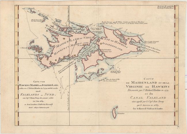
Subject: Falkland Islands

Period: 1774 (published)

Publication: Cartes et Figures des Voyages...

Color: Hand Color

Size:
11.6 x 8.6 inches
29.5 x 21.8 cm
Download High Resolution Image
(or just click on image to launch the Zoom viewer)

This striking chart of the Falkland Islands shows many harbors, channels, capes, bays, shoals, islands, rocks, and soundings. The title erroneously claims that Sir Richard Hawkins discovered the Falkland Islands in 1574, when he would have been twelve years old. Hawkins did map the northern coastline of what may have been the islands in 1593, but the islands appeared on charts before that date. The map identifies a rock named by Hawkins and traces the track of Capt. John Strong's exploration in 1689, when he discovered the sound in between the two main islands. This edition of the map is from Hawkesworth's Cartes et Figures des Voyages..., published by Saillant and Nyon.

References:

Condition: B+

A nice impression on watermarked paper. There is minor foxing and a fold separation confined to the bottom left blank margin that has been closed with archival materials.

Estimate: $110 - $140

Sold for: $55

Closed on 2/8/2017

Archived