Catalog Archive
Auction 161, Lot 475

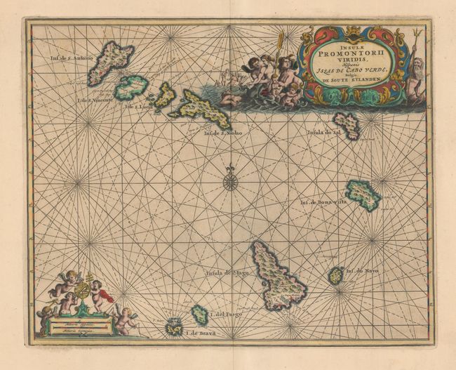
"Insulae Promontorii Viridis, Hispanis Issas de Cabo Verde, Belgis de Soute Eylanden", Ogilby, John

Subject: Cape Verde Islands

Period: 1670 (published)

Publication: Africa: Being an Accurate Description...

Color: Hand Color

Size:
12.3 x 9.8 inches
31.2 x 24.9 cm
Download High Resolution Image
(or just click on image to launch the Zoom viewer)

John Ogilby's 'Britannia' was published between 1675 and 1698. It is a landmark in the mapping of England and Wales. Its unique format constituted the first national road-atlas of any country in Western Europe. It was composed of maps of seventy-three major roads and cross-roads, presented in a continuous strip-form, on a uniform scale of one inch to a mile. Each beautiful map includes wonderful detail of the countryside with each strip containing a large compass rose to indicate changes in direction.

A beautiful small sea chart of the important Cape Verde Islands based on Blaeu's map of the same title. Beautifully embellished with rhumb lines and a compass rose, it features two cartouches with cavorting cherubs and mermaids.

References: Shirley (BL Atlases) T.OGIL-1a #34.

Condition: A

A dark impression on paper with very wide margins and light printer's ink residue.

Estimate: $190 - $220

Sold for: $140

Closed on 2/8/2017

Archived