Catalog Archive
Auction 161, Lot 458

"Grundriss der Stadt Carthagena in Indien... / Plan de la Ville de Carthagene des Indes...", Ulloa, Antonio de

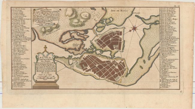
Subject: Cartagena, Colombia

Period: 1755 (circa)

Publication: Illustrations de Voyage Historique de l'Amérique Méridionale

Color: Hand Color

Size:
14.3 x 7 inches
36.3 x 17.8 cm
Download High Resolution Image
(or just click on image to launch the Zoom viewer)

This rare map appeared in a French edition of Antonio de Ulloa and Jorge Juan's Relacion Historica del Viaje a la America Meridional..., a seminal work on South American geography, culture, and history written by the two scientists after nearly a decade spent exploring the continent. Spaniards Ulloa and Juan were appointed to the French Geodesic Mission to South America. The purpose of the mission was to measure a degree of meridian arc at the equator, and the chosen location for the measurements was Ecuador. The measurements would then be compared with similar measurements made near the North Pole, with the goal of determining the true shape of the earth.

This detailed bird's-eye plan of the important port city of Cartagena includes titles and place names in both French and German. Lettered and numbered keys identify numerous places and buildings within the city. A compass rose orients north to the bottom left.

References:

Condition: B+

Issued folding, now flattened, with light toning and marginal soiling. There are a few tiny tears along the edges of the sheet.

Estimate: $275 - $350

Sold for: $425

Closed on 2/8/2017

Archived